
Pattigham
|
Pattigham
|
||
|---|---|---|
| coat of arms | Austria map | |
 |
|
|
| Basic data | ||
| Country: | Austria | |
| State : | Upper Austria | |
| Political District : | Ried im Innkreis | |
| License plate : | RI | |
| Surface: | 11.3 km² | |
| Coordinates : | 48 ° 9 ' N , 13 ° 29' E | |
| Height : | 512 m above sea level A. | |
| Residents : | 996 (January 1, 2020) | |
| Population density : | 88 inhabitants per km² | |
| Postal code : | 4910 | |
| Area code : | 07754 | |
| Community code : | 4 12 21 | |
| NUTS region | AT311 | |
| Address of the municipal administration: |
Main Street 10 4910 Pattigham |
|
| Website: | ||
| politics | ||
| Mayor : | Johann Urwanisch ( ÖVP ) | |
|
Municipal Council : (2015) (13 members) |
||
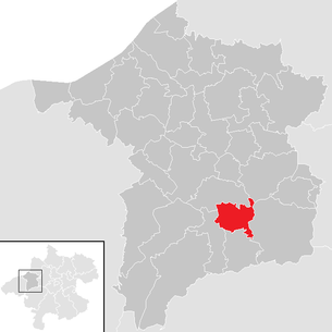
| Location of Pattigham in the Ried im Innkreis district | ||
  |
||
| Source: Municipal data from Statistics Austria | ||

Pattigham is a municipality in the Austrian state of Upper Austria in the district of Ried im Innkreis in the Innviertel with 996 inhabitants (as of January 1, 2020). The community is located in the judicial district of Ried im Innkreis .
geography
Pattigham is located at an altitude of 512 m in the Innviertel. The extension is 4.4 km from north to south and 4.6 km from west to east. The total area is 11.22 km². 15% of the area is forested, 77% of the area is used for agriculture.
Community structure
The municipality includes the following localities (population in brackets as of January 1, 2020):
- Atzing (18)
- Daring (23) including Rödt
- Dunzing (115)
- Haging (64)
- Hochkuchl (46)
- Courtyard (99)
- Oberbrunn (32)
- Pattigham (475)
- Pattighamried (36)
- Saint Thomas (18)
- Chess (13)
- Schwarzenbach (13)
- Senzenberg (10)
- Zeilach (34)
history
In the 7th / 8th Christian life began in the Bavarian tribal duchy in the 19th century. The Cathedral Chapter of Passau built the St. Laurenz Church from 1480 to 1490, which was granted baptismal and burial rights. In 1633, the parish of Hohenzell with the branch churches Pattigham and St. Thomas in the Eberschwang deanery is mentioned in a Passau register . In 1852 the parish was established.
Since the founding of the Duchy of Bavaria, the place was Bavarian until 1779 and came to Austria after the Treaty of Teschen with the Innviertel (then 'Innbaiern'). Briefly Bavarian again during the Napoleonic Wars , since 1814 it has finally belonged to Upper Austria.
After the annexation of Austria to the German Reich on March 13, 1938, the place belonged to the Gau Oberdonau . After 1945 the restoration of Upper Austria took place.
- Timetable
- 1160 Pattichinheim - first documented mention in the 5th Passau Codex; 1190 Haging
- 13th century. First bathing facility in the St. Thomas Spa in a wooden bath house
- 1340 The Vogtamt - belonging to the Cathedral Chapter Passau - is established as the 5th office of the Ried Regional Court.
- 1380 Castle construction by the Kuchlers Konrad IV and Hans am Hochkuchl
- 15th century. The pilgrimage church of St. Thomas is built
- 1463 The Hochkuchler family dies out with Hans
- 1480–1490 The Passau Cathedral Chapter builds the St. Laurenz Church in Paticheim
- 1633 The parish of Hohenzell with the branch churches Pattigham and St. Thomas is mentioned in a Passau register
- 1660 Elector Ferdinand Maria from Bavaria donates the Thomas altar to the pilgrimage church of St. Thomas
- 1717 The 2nd Rotunda Chapel at St. Thomas is built
- May 13th 1779 The Innviertel , belonging to Bavaria for a millennium, comes to Austria
- 1785 The Church of St. Thomas is closed under Emperor Joseph II and demolished in 1787
- 1791 First elementary school in Pattigham, first teacher is Georg Böheim
- 1850 Pattigham becomes a local parish with 903 residents in 154 houses
- 1852 Pattigham becomes an independent parish
- 1892 The old onion dome of the parish church is replaced by a Gothic pointed helmet
- 1893 A fire at the St. Thomas bathing establishment ends bathing operations
- 1905 The healing water from St. Thomas is directed to Ried
- 1914–1918 First World War (24 killed, 7 missing)
- 1939–1945 Second World War (30 killed, 22 missing, 900 refugees in Pattigham)
- 1959 street lights in Pattigham
- 1969 Sports field construction (expanded in 1989)
- 1982 Opening of the tennis facility
- 1995 opening of the new Raiffeisenbank building; Sewerage by the Oberach Cleanliness Association (Pattigham, Pramet, Schildorn)
- 1996 Inauguration of the new municipal office
- 1997 Blessing of the parish center
- 2000 Opening of the fire station , the musicians' home and the waste material collection island
Population development
In 1991 the community had 789 inhabitants according to the census, in 2001 it had 813 inhabitants. The proximity to the district town of Ried and the beautiful surroundings are responsible for the fact that many new houses have been built in Pattigham in recent years and the population has increased steadily as a result. Due to the lack of industrial and trading companies and apart from a few small businesses, the population is forced to commute and take jobs primarily in Ried or in the surrounding communities.
politics
The municipal council has a total of 13 members.
- With the municipal council and mayoral elections in Upper Austria in 2015 , the municipal council has the following distribution: ÖVP 7, FPÖ 4 and SPÖ 2 mandates.
- mayor
- since February 2020 Johann Urwanisch (ÖVP)
- 2003–2020 Franz Moser (ÖVP)
coat of arms
Since 1982 Pattigham has been allowed to use a municipal coat of arms based on a design by the chief officer Franz Wambacher. Blazon : Split at an angle; above in gold a black, erect, red armored and tongued wolf, below in green a silver daisy flower with a golden clasp. The municipality colors are black, white and green.
The Passauian wolf points to the origins of the place, the daisies blossom to the beautiful, predominantly agricultural area.
traffic
- Street: Pattigham can be reached via Frankenburger Straße L 509.
- Train: With the Oberbrunn stop there is a train connection of the Hausruckbahn , which is 3 km from the center of Pattigham.
Culture and sights

- Pattigham Parish Church : The church is a late Gothic single-nave sacred building with a three-bay choir. The baroque high altar comes from the workshop of Thomas Schwanthaler . This was originally built for the pilgrimage church of St. Thomas around 1665/70 and transferred to the Laurentius church in the course of the Josephine reforms .
- The pilgrimage church of St. Thomas was built in the 12th century at the foot of the "Badleithen" - popularly known as the Bründl chapel. Due to the large influx of pilgrims, a spacious pilgrimage church was built in the 15th century (branch church of the mother parish of Hohenzell). In order to get an heir to the throne, Elector Ferdinand Maria from Bavaria and his wife Henriette Adelheid from Savoy donated the Thomas Altar around 1660. In 1785, as a result of the reforms of Emperor Joseph II , the church was deemed superfluous, closed and demolished in 1787. The altar was transferred to Pattigham Parish Church.
education
The only educational facility in the parish is Pattigham Elementary School.
societies
- Bible round
- Free Style Club Ried
- 2 volunteer fire brigades
- Gold hood group
- Catholic women's movement
- Children's liturgy group
- Rural youth
- music Society
- Mothers round
- Sports clubs with several sections
- USV Pattigham / Pramet football club
- X-Trail freaks
- Future Pattigham 2030
Personalities
- Josef Itzinger (1918–2012), Consistorial Councilor
Web links
- Pattingham Congregation website
- Further information about the municipality of Pattigham on the geo-information system of the federal state of Upper Austria .
- 41221 - Pattigham. Community data, Statistics Austria .
Individual evidence
- ↑ Statistics Austria: Population on January 1st, 2020 by locality (area status on January 1st, 2020) , ( CSV )
- ^ Province of Upper Austria, results of the 2015 elections. Accessed April 11, 2019 .
- ↑ Urwanisch follows Moser. In: mein district.at. February 2, 2020, accessed February 23, 2020 .
- ^ State of Upper Austria, history and geography, coat of arms. Retrieved April 11, 2019 .

Andrichsfurt | Antiesenhofen | Aurolzmünster | Eberschwang | Eitzing | Geiersberg | Geinberg | Belts | Hohenzell | Kirchdorf am Inn | Kirchheim im Innkreis | Lamb rights | Lohnsburg am Kobernaußerwald | Mehrnbach | Mettmach | Mörschwang | Mühlheim am Inn | Neuhofen im Innkreis | Obernberg am Inn | Place in the Innkreis | Pattigham | Peterskirchen | Pramet | Reichersberg | Ried im Innkreis | St. Georgen near Obernberg am Inn | St. Marienkirchen am Hausruck | St. Martin im Innkreis | Schildorn | Senftenbach | Taiskirchen im Innkreis | Tumeltsham | Utzenaich | Waldzell | Weilbach | Wippenham