
Utzenaich
|
Utzenaich
|
||
|---|---|---|
| coat of arms | Austria map | |
 |
|
|
| Basic data | ||
| Country: | Austria | |
| State : | Upper Austria | |
| Political District : | Ried im Innkreis | |
| License plate : | RI | |
| Surface: | 20.34 km² | |
| Coordinates : | 48 ° 17 ' N , 13 ° 28' E | |
| Height : | 398 m above sea level A. | |
| Residents : | 1,587 (January 1, 2020) | |
| Population density : | 78 inhabitants per km² | |
| Postal code : | 4972 | |
| Area code : | 07751 | |
| Community code : | 4 12 33 | |
| NUTS region | AT311 | |
| Address of the municipal administration: |
Hofmark 3 4972 Utzenaich |
|
| Website: | ||
| politics | ||
| Mayor : | Karl Ehwallner ( ÖVP ) | |
|
Municipal Council : (2015) (19 members) |
||
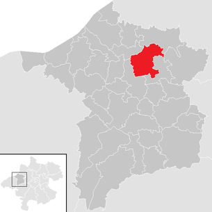
| Location of Utzenaich in the district of Ried im Innkreis | ||
  |
||
| Source: Municipal data from Statistics Austria | ||

Utzenaich ( Bavarian : Ùtznoa ) is a municipality in Upper Austria in the district of Ried im Innkreis in the Innviertel with 1587 inhabitants (as of January 1, 2020) about 7 km north of Ried . The community is located in the judicial district of Ried im Innkreis .
geography
Utzenaich is 398 m above sea level in the Innviertel. The extension is from north to south 6.1 km, from west to east 5.9 km. The total area is 20.2 km². 8.9% of the area is forested, 81.2% of the area is used for agriculture.
Neighboring communities
| St. Martin | Lamb rights | |
.svg)
|
Taiskirchen in the Innkreis | |
| Aurolzmünster | Andrichsfurt |
structure
The municipality includes the following localities (population in brackets as of January 1, 2020):
- Aigen (16)
- Albertsedt (21)
- Antiesen (136)
- Then (13)
- Dieting (8)
- Dobl (17)
- Dulmading (51)
- Etting (6)
- Flakes (4)
- Gaisbach (11)
- Gunderpolling (239)
- Kingdom of Heaven (10)
- Murau (41)
- Rabenfurt (87)
- Reschenedt (9)
- Stelzham (23)
- Straß (16) including Oberhaselberg
- Unterhaselberg (20)
- Utzenaich (689)
- Weilbolden (31)
- Wilhelming (47)
- Wimm (20)
- Windhag (41) including Frein
- Wohlmuthen (17)
- Wolfstrasse (14)
Population development
In 1991 the municipality had 1,385 inhabitants according to the census, in 2001 it had 1,496 inhabitants. The migration balance was only slightly positive (+6), but the birth balance was very high (+105). With both balances remaining positive over the next decade, the population rose to 1,536 in 2011.
history
The name Utzenaich was first mentioned in a document in 1140. The place was administered by the old Bavarian noble family of the Tattenbach families .
From the founding of the Duchy of Bavaria, Utzenaich was Bavarian until 1779 and came briefly to Austria after the Treaty of Teschen and the Innviertel (then 'Innbaiern'). Bavarian again during the Napoleonic Wars , the place has belonged to Upper Austria since 1814.
After the annexation of Austria to the German Reich on March 13, 1938, the place belonged to the Gau Oberdonau . After 1945 the restoration of Upper Austria took place.
In October 1944 a “foreign national children's home” was set up in the Wilhelming district, in which children who had been taken from foreign civil workers ( “Eastern workers” ) were housed. By May 9, 1945, 34 out of 60 infants had died of inadequate care and malnutrition.

Culture and sights
- Parish church Utzenaich
- Utzenaich Castle
- Noble seat Murau
- Memorial for the deceased children of the alien children's home
economy
Austria's first “green biorefinery ” has been operating in Utzenaich since May 2009 . In this demonstration plant, grass silage is separated into its components in order to obtain lactic acid and amino acids . Biogas is obtained from the residues . The capacity of the plant is one tonne of silage per hour.
politics
The municipal council has a total of 19 members. With the municipal council and mayoral elections in Upper Austria in 2015 , the municipal council has the following distribution: 10 ÖVP, 5 FPÖ and 4 SPÖ.
- mayor
- Karl Ehwallner (ÖVP)
- Vice Mayor is Günther Lengauer (ÖvP)
coat of arms
Blazon : Under a blue shield head, inside a silver brook trout, in gold a green, leafless branch with three acorns placed at an angle to the left. The community colors are blue-yellow
Individual evidence
- ↑ Statistics Austria: Population on January 1st, 2020 by locality (area status on January 1st, 2020) , ( CSV )
- ↑ Statistics Austria, A look at the community Utzenaich, population development. Retrieved April 10, 2019 .
- ↑ http://www.kirchenzeitung.at/newsdetail/rubrik/orte-der-erinnerung/
- ^ Gottfried Gansinger: Fremdvölkisches Kinderheim Utzenaich (1944-1945). Remembrance for the future , Studienverlag 2019, ISBN 978-3-200-06155-2 .
- ↑ The world's first green biorefinery for grass silage opened. Retrieved June 19, 2009.
- ^ Province of Upper Austria, results of the 2015 elections. Accessed April 10, 2019 .
- ^ State of Upper Austria, history and geography, coat of arms. Retrieved April 10, 2019 .
Web links
- Further information about the municipality of Utzenaich can be found on the geographic information system of the federal state of Upper Austria .

Andrichsfurt | Antiesenhofen | Aurolzmünster | Eberschwang | Eitzing | Geiersberg | Geinberg | Belts | Hohenzell | Kirchdorf am Inn | Kirchheim im Innkreis | Lamb rights | Lohnsburg am Kobernaußerwald | Mehrnbach | Mettmach | Mörschwang | Mühlheim am Inn | Neuhofen im Innkreis | Obernberg am Inn | Place in the Innkreis | Pattigham | Peterskirchen | Pramet | Reichersberg | Ried im Innkreis | St. Georgen near Obernberg am Inn | St. Marienkirchen am Hausruck | St. Martin im Innkreis | Schildorn | Senftenbach | Taiskirchen im Innkreis | Tumeltsham | Utzenaich | Waldzell | Weilbach | Wippenham