
Taiskirchen in the Innkreis
|
market community Taiskirchen in the Innkreis
|
||
|---|---|---|
| coat of arms | Austria map | |
 |
|
|
| Basic data | ||
| Country: | Austria | |
| State : | Upper Austria | |
| Political District : | Ried im Innkreis | |
| License plate : | RI | |
| Surface: | 34.47 km² | |
| Coordinates : | 48 ° 16 ' N , 13 ° 34' E | |
| Height : | 475 m above sea level A. | |
| Residents : | 2,416 (January 1, 2020) | |
| Population density : | 70 inhabitants per km² | |
| Postal code : | 4753 | |
| Area code : | 07764, 07765, 07750 | |
| Community code : | 4 12 31 | |
| NUTS region | AT311 | |
| Address of the municipal administration: |
Hofmarkt 29 4753 Taiskirchen im Innkreis |
|
| Website: | ||
| politics | ||
| Mayor : | Johann Weirathmüller ( ÖVP ) | |
|
Municipal Council : (2015) (25 members) |
||
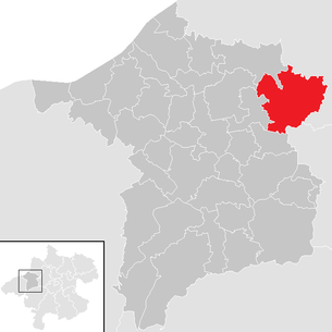
| Location of Taiskirchen im Innkreis in the Ried im Innkreis district | ||
  |
||
| Source: Municipal data from Statistics Austria | ||

Taiskirchen im Innkreis ( Bavarian : Tåskira) is a market town in Upper Austria in the district of Ried im Innkreis in the Innviertel with 2,416 inhabitants (as of January 1, 2020). The community is located in the judicial district of Ried im Innkreis .
geography
Taiskirchen im Innkreis lies at an altitude of 475 m in the Innviertel. The extension is 7.7 km from north to south and 7.6 km from west to east. The total area is 34.53 km². 13.7% of the area is forested, 79.4% of the area is used for agriculture.
structure
Districts
The municipality includes the following localities (population in brackets as of January 1, 2020):
- Aichet (32) including Großwimm
- Altmannsdorf (84)
- Arling (41) with Gferat and Maisling
- Baumgarten (23) with Kamplern and Spader
- Fire sites (35)
- Breitenried (347) including Hörmansedt
- Bruckleiten (41)
- Edtleiten (43)
- Ellerbach near Taiskirchen im Innkreis (39)
- Flohleiten (91) including Kaserfeld and unpleasantness
- Gansing (27)
- Gotthalmsedt (16)
- Gunzing (25)
- Helfingsdorf (81) including Aspach, Edt and Kirchbach
- Hohenerlach (45)
- Jebing (38)
- Jedretsberg (24) including Kleinreinthal
- Kainzing (57) and Radling
- Kleingaisbach (75) including Edt
- Kühdobl (44)
- Lacquers (40) including Rotten and Vicht
- Lindet (23)
- Petersham (21)
- Treasure Village (4)
- Sittling (8)
- Taiskirchen im Innkreis (769)
- Tiefenbach (64)
- Subreitried (52)
- Wiesenberg (73) including Gebetsedt and plateau
- Wietraun (20)
- Wohleiten (64)
- Wolfsedt (18)
- Zahra (52) including Bern
Cadastral communities
- Taiskirchen (46159)
- Arling (46102)
- Fire sites (46105)
- Breitenried (46106)
- Jedretsberg (46126)
- Kleingaisbach (46130)
- Untertiefenbach (46163)
- Unterwietraun (46164)
- Wiesenberg (46170)
Neighboring communities
The neighboring communities are:
Andrichsfurt , Utzenaich , Lambrechte , Zell an der Pram , Riedau , Dorf an der Pram , Pram , Peterskirchen

history
Since the founding of the Duchy of Bavaria , the place was Bavarian until 1779 and came to Austria after the Treaty of Teschen with the Innviertel (then Innbaiern ). During the Napoleonic Wars briefly royal Bavarian again , since 1814 it has finally belonged to Austria ob der Enns .
After the annexation of Austria to the German Reich on March 13, 1938, the place belonged to the Gau Oberdonau . After 1945 the restoration of Upper Austria took place.
In 1990 Taiskirchen in the Innkreis was raised to a market town.
Population development
In 1991 the community had 2,356 inhabitants according to the census. Due to a strongly positive birth balance, the population increased to 2,406 inhabitants by 2001, despite a negative migration balance. In the next decade, the population increased further to 2,442 in 2011.
.jpg)
Culture and sights
music
The market music band from Taiskirchen im Innkreis was founded in 1849 by Joseph Gramberger with a strength of 14 men. In 1999 she moved to the newly established Taiskirchen State Music School.
Leisure activities
The starting point of the Taiskirchner bike and hiking trail is right there . The cycle path , known as particularly family-friendly , leads through the hilly landscape of the central Innviertel and is popular with tourists .
Taiskirchen reservoir

The retention basin Pramtal - as the reservoir is officially called - was built between 1978 and 1980 on the municipal boundaries of Taiskirchen im Innkreis, Pram and Dorf an der Pram . The reservoir is therefore on the district boundaries of the districts of Ried im Innkreis , Schärding and Grieskirchen . The retention basin has a groundwater surface of 6 hectares. The water of the bathing areas partially meets the requirements for bathing water according to the bathing hygiene ordinance. Camping and barbecuing at the given places is free of charge.
Festivals and Celebrations
Taiskirchen is a very lively community with a number of leisure activities. Due to the functioning of the association, festivals have arisen that are known far beyond the district boundaries:
The most famous festivals are:
- Rock in Gaisbach (in May)
- Sea festival (usually at the end of June)
- Court Festival (in July)
- Gruamfest (usually in June)
A football hobby tournament is held every year on the sports field. Usually 10 teams play with 6 players each.
In 2007 the Wiats team prevailed over Riyadh and beat Team 7 5-0 in the final .
In winter, the drag lift on the Kinzenberg opens .
politics
Mayor is Johann Weirathmüller from the ÖVP .
coat of arms
Blazon : roughened obliquely to the left in silver and blue ; topped with a red sloping bar with three silver eagles mutilated at their fangs . The community colors are red-white-blue.
Taiskirchen has had the municipal coat of arms since 1978. The coat of arms of Bavaria (blue - white) and the coat of arms of Lorraine (banner with eagle) are combined. This shows that the Innviertel, and thus also Taiskirchen , was Bavarian until the Peace of Teschen in 1779 and the Treaty of Munich until 1816 , with which the boundary conditions were established.
Personalities
- Makarius Falter (1762–1843), piano teacher and music publisher
- Erwin Machtlinger , 17 times Austrian national champion in motocross
Trivia
In December 1936, the farmer Karolina Einböck from Sittling was murdered by her husband Anton, after which he set fire to his farm to cover up the crime. For this act, Anböck was sentenced to “ death by hanging” on July 20, 1937 in Ried by a jury chaired by District Court President Hagen and executed on October 13, 1937 by the executioner Johann Lang in Ried.
Web links
- Community website
- Website of the Taiskirchen reservoir
- Map in the Digital Upper Austrian Room Information System ( DORIS )
- Further information about the municipality Taiskirchen im Innkreis on the geo-information system of the federal state of Upper Austria .
- Bibliography on Taiskirchen in the forum OoeGeschichte.at
Individual evidence
- ↑ Statistics Austria: Population on January 1st, 2020 by locality (area status on January 1st, 2020) , ( CSV )
- ^ Alfred Webinger: Field names, court names and family names from Taiskirchen. In: Upper Austrian homeland sheets . Volume 6, Linz 1952, p. 378 ( online (PDF) in the forum OoeGeschichte.at).
- ↑ Changes to the community from 1945 (associations, partitions, name and status changes). Statistics Austria, p. 173 , accessed on February 6, 2019 .
- ↑ Statistics Austria, A look at the community Taiskirchen in the Innkreis, population development. Retrieved April 10, 2019 .
- ^ Province of Upper Austria, results of the 2015 elections. Accessed April 10, 2019 .
- ^ State of Upper Austria, history and geography, coat of arms. Retrieved April 10, 2019 .
- ↑ NN, Heavy atonement for a terrible deed. The murderer of the husband, Einsteins, executed , in: Rieder Volkszeitung (57th vol., No. 41), October 14, 1937, p. 10.
- ↑ Descriptions of the crime and the execution, as they were printed in the current reporting at the time, can also be read on ANNO - AustriaN Newspapers Online (1937).

Andrichsfurt | Antiesenhofen | Aurolzmünster | Eberschwang | Eitzing | Geiersberg | Geinberg | Belts | Hohenzell | Kirchdorf am Inn | Kirchheim im Innkreis | Lamb rights | Lohnsburg am Kobernaußerwald | Mehrnbach | Mettmach | Mörschwang | Mühlheim am Inn | Neuhofen im Innkreis | Obernberg am Inn | Place in the Innkreis | Pattigham | Peterskirchen | Pramet | Reichersberg | Ried im Innkreis | St. Georgen near Obernberg am Inn | St. Marienkirchen am Hausruck | St. Martin im Innkreis | Schildorn | Senftenbach | Taiskirchen im Innkreis | Tumeltsham | Utzenaich | Waldzell | Weilbach | Wippenham
Aichet | Altmannsdorf | Arling | Baumgarten | Fire sites | Breitenried | Bruckleiten | Edtleiten | Ellerbach | Flea guide | Gansing | Gotthalmsedt | Günzing | Helfingsdorf | Hohenerlach | Jebing | Jedretsberg | Kainzing | Kleingaisbach | Kühdobl | Lacquers | Lindet | Petersham | Treasure Village | Sittling | Taiskirchen im Innkreis | Tiefenbach | Subreitried | Wiesenberg | Wietraun | Wohleiten | Wolfsedt | Zahra