
This side (parish of St. Martin)
|
This side ( capital of a market town ) locality cadastral municipality St. Martin im Innkreis This side |
|||
|---|---|---|---|
|
|||
| Basic data | |||
| Pole. District , state | Ried im Innkreis (RI), Upper Austria | ||
| Judicial district | Ried im Innkreis | ||
| Pole. local community | St. Martin im Innkreis | ||
| Coordinates | 48 ° 17 '39 " N , 13 ° 26' 25" E | ||
| height | 372 m above sea level A. | ||
| Residents of the village | 1235 (January 1, 2020) | ||
| Building status | 256 (2001) | ||
| Area d. KG | 4.57 km² | ||
| Post Code | 4973 Sankt Martin im Innkreis | ||
| Statistical identification | |||
| Locality code | 10662 | ||
| Cadastral parish number | 46029 | ||
| Counting district / district | St.Martin im Innkreis (41 228 000) | ||
 The parish church of St. Martin and on the left the regional music school |
|||
| Source: STAT : index of places ; BEV : GEONAM ; DORIS | |||

This side is a place in the Innviertel in Upper Austria , and the main town ( market town ), locality and cadastral municipality of the municipality of St. Martin im Innkreis in the district of Ried im Innkreis .
geography
The place is around 372 m above sea level. A. in Antiesental , approx. 10 km north of the district town of Ried im Innkreis , as an original street village , today Haufendorf on Hausruck Strasse (B143, former Hausruck-Bundesstrasse), which runs along the Antiesen.
The village comprises around 280 buildings (as of 2012) with around 900 inhabitants. Together with the beyond , this side forms the actual place Sankt Martin , which is grouped around Castle Arco-Zinneberg (Castle St. Martin) . This side includes all houses between the Senftenbach in the north and the power station in the south, including the houses at the train station and the houses below Ortisei towards Karchham .
The place name this side is literal, the cadastral community of St. Martin in the Innkreis Diesseits includes all parts of the community that - viewed from the castle - are on this side of the Antiesen (the other parts of the community are "beyond"). This also includes the villages of Rotten Breitenaich right on the main road northwards towards Ort im Innkreis , the parts of Hofing belonging to the municipality (remainder of Aurolzmünster municipality ) southwards towards Ried, and Sindhöring northwest and Karchham west on the left slopes of the Antiesental.
Neighborhoods and cadastral communities:
|
(both KG, Gem. Reichersberg ) |
Place in the Innkreis (KG, Gem.)
|
|
|
Greifling (KG, Gem. Mörschwang )
|
.svg)
|
Beyond (Ortsch. And KG) |
|
Grasping toy (KG)
(both in Senftenbach ) |
Hofing (Gem. St. Martin and Aurolzmünster ) Forchtenau (KG, Gem. Aurolzmünster) |
Utzenaich (KG)
(both by Utzenaich ) |
history

In 1084 St. Martin was first mentioned as a fief of the Passau bishopric . Around 1150 it was called Ainwicus de sancti Martino 'Village of St. Martin'. The lords of Schwent appear as feudal bearers of St. Martin in 1166. The place used to be called simply St. Martin this side , and was the Hofmark of the castle, in the extension of today's cadastral community. Beyond is not recorded early. Today the place name is mainly known as an address, the place itself is commonly called Sankt Martin.
|
Krld. Austrian od Enns ( Mon. Austria ) (1) |
Bld. Upper Austria ( Rep. Austria ) |
|||||||||
| 1785/88 (1) | 1824 | 1825 | 1869 | 1951 | 1961 | 1971 | 1981 | 1991 | 2001 | |
|---|---|---|---|---|---|---|---|---|---|---|
| place | - | - | - | 445 | 731 | 716 | 693 | 697 | 763 | 831 |
| 59 | - | - | 73 | 115 | 157 | 183 | 215 | 233 | 256 | |
| KG | - | 630 | 708 | 625 | 956 | 926 | 910 | 948 | 1051 | 1099 |
| 84 | 91 | 97 | 97 | 158 | 205 | 243 | 293 | 327 | 355 | |
- (1) Crown land officially 1779; Information 1785 (presumption) for the place, 1788 for the KG; at the time part of the Archduchy of Austria ; 1824/25: Austrian Empire ; 1869: Austria-Hungary
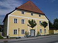
Infrastructure and sights
Most of the more important addresses of the congregation can be found on this side:
- Municipal Office
- St. Martin / Arco-Zinneberg Castle (listed)
- fire Department
- St. Martin im Innkreis station of the (extended) Salzkammergut Railway (Attnang-Puchheim - Schärding)
- Elementary school (listed)
- Parish church (listed)
- Rectory (listed)
- Cemetery (listed)

Castle - portal wing

Castle - utility wing

Martinskirche
Rectory

Elementary school

Cemetery with urn chapel
.jpg)
.jpg)

.jpg)
.jpg)
.jpg)
proof
- 41228 - St. Martin im Innkreis. Community data, Statistics Austria .
- ↑ a b Address search on this side at DORIS
- ^ A b Norbert Grabherr: Historical-topographical manual of the fortifications and mansions of Upper Austria. Series of publications by the Austrian Working Group on Prehistory and Early History. 1975, p. 102 f.
-
↑ a b c Kurt Klein (edit.): Historical local dictionary . Statistical documentation on population and settlement history. Ed .: Vienna Institute of Demography [VID] d. Austrian Academy of Sciences . Upper Austria Part 2, St. Martin im Innkreis Diesseits KG / Diesseits
, S.
26th f . ( Online document , explanations . Suppl . ; both PDF - oD [updated]). Special references: 1785: House numbers for localities in the Innviertel, from Ignaz De Luca: Geographical Handbook from the Austrian State . 1st vol., 1791 (probably from around 1785). • 1788, 1824: Municipality (ed.): St. Martin im Innkreis , 1984. • 1825: Military conscription 1823/30; adorned by Benedikt Pillwein: history, geography and statistics of the Archduchy of Austria ob der Enns and the Duchy of Salzburg. 1827/32; New edition 1843. • 1869: Statistische Central-Commission (Hrsg.): Local repertories of the kingdoms and countries represented in the Austrian Imperial Council . (1871 ff.). • 1951 and later: Austrian Central Statistical Office / Statistics Austria (ed.): Directory of places . (Results of the census).
- ↑ cf. the information 1869 for KG and Hofmark

Cadastral communities: St. Martin im Innkreis Diesseits | St. Martin im Innkreis Beyond
Locations: Breitenaich | This side | Hofing | Hötzlarn | Beyond | Karchham | Koblstadt | Sindhoring
Market place: This side | Village: Beyond | Rotten: Breitenaich • Hofing • Karchham • Sindhöring | Scattered houses: Hötzlarn • Koblstadt | Other locations: Arco-Zinneberg Castle
Counting district: St.Martin im Innkreis