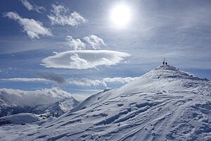
Ochsenkopf (Kitzbühel Alps)
| Ox head | ||
|---|---|---|
| height | 2469 m above sea level A. | |
| location | Tyrol - Salzburg , Austria | |
| Mountains | Kelchsauer Alps , Kitzbühel Alps | |
| Dominance | 5.6 km → Torhelm | |
| Notch height | 358 m ↓ Schöntalsee | |
| Coordinates | 47 ° 16 '30 " N , 12 ° 4' 42" E | |
|
|
||
The Ochsenkopf on the border between Tyrol and Salzburg is at an altitude of 2469 m above sea level. A. one of the highest peaks in the Kitzbühel Alps .
Location and landscape
The mountain lies north above the Gerlos pass ( 1531 m above sea level ), the transition from the Tyrolean Zillertal to the Salzburg Oberpinzgau .
To the northeast is the Salzach vulture ( 2469 m above sea level / 2466 m above sea level ), from which the Salzach rises in the municipality of Wald im Pinzgau ; Directly to the east under the Ochsenkopf, the Müllachbach is the first right tributary to come to it; there lies the Müllachgeier ( 2254 m above sea level ) opposite . In the southwest of the municipality of Gerlos, the Neederbach runs to the Krummbach , which flows over the Gerlostal to the Ziller and Inn . To the north is the Frommbach , municipality of Hopfgarten im Brixental , one of the source streams of the Kelchsauer Ache , then to the Inn near Wörgl.
From the Gerlospass the ridge climbs over the Königsleitenspitze ( 2315 m above sea level ), below the Sattelscharte there is a larger pond for the ski area. The Nebelkarspitze ( 2339 m above sea level ) follows on the ridge to the Salzachgeier . West is the Pallspitze ( 2389 m above sea level. A. ), at the Pallscharte is the Blue paints and some other small cirque lakes .
Climbs
The mountain can be reached from the Almdorf Königsleiten and from Gerlos-Innertal , whereby from the Falschriedel the trail leads over an exposed ridge with rocks (surefootedness and a head for heights required); between these places lies the Königsleiten ski area, which is part of the Zillertal Arena . North of this heavily developed area, the southeastern Kelchsau Alps are quickly left quite natural, and the path markings into the Kelchsau are also little developed. From the Kelchsau the summit can be reached from the Lange Grund via the Pallscharte on climbing tracks over the saddle north of the summit (no marked path from Pallscharte). The mountain is mainly known as a ski tour .

