Odet (river)
| Odet | ||
|
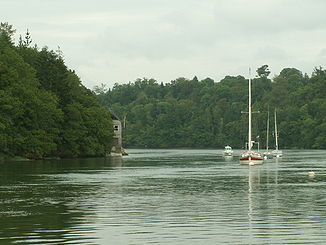
The Odet with the rising tide |
||
| Data | ||
| Water code | FR : J4-0190 | |
| location | France , Brittany region | |
| River system | Odet | |
| source | in the municipality of Saint-Goazec, 48 ° 8 ′ 9 ″ N , 3 ° 44 ′ 5 ″ W |
|
| Source height | approx. 170 m | |
| muzzle | at Bénodet in the Atlantic Coordinates: 47 ° 51 ′ 48 ″ N , 4 ° 6 ′ 21 ″ W 47 ° 51 ′ 48 ″ N , 4 ° 6 ′ 21 ″ W |
|
| Mouth height | 0 m | |
| Height difference | approx. 170 m | |
| Bottom slope | approx. 2.7 ‰ | |
| length | 62 km | |
| Left tributaries | Jet , Anse de Cadou | |
| Right tributaries | Langelin, Steïr , Corroac'h | |
| Medium-sized cities | Quimper | |
| Navigable | from the mouth to Quimper | |
The Odet is a river in France in the Finistère department in Brittany . It rises in the Montagnes Noires (German: Black Mountains ) in the municipality of Saint-Goazec . The Odet generally drains south-west, crosses the Stangala Gorge and flows into the Atlantic after 62 kilometers at Bénodet ( Breton: Ben for mouth, i.e. mouth of the Odet ) in a wide estuary .
The catchment area of the river corresponds to the Pays Glazig in the Cornouaille landscape . Its whitewater character creates - like most Breton watercourses - floods in autumn and winter, the effect of which intensifies urbanization and the sealing of the soil, as well as the leveling of agricultural soils (destruction of the embankment since the 1960s ).
In addition to Bénodet, the municipality of Briec-de-l'Odet is named after the Odet , and so was the town of Quimper , which was then still called Montagne-sur-Odet during the French Revolution .
shipping
The 20-kilometer-long estuary of the Odet forms a wooded gorge above Bénodet, which can be navigated by ships as a tourist attraction at high tide. Shipping is possible to Quimper. Below Quimper, a trading port ( Port de Corniguel ) with a quay length of 500 meters was built for smaller ships .
