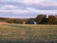
Oertelshain
|
Oertelshain
Remse municipality
Coordinates: 50 ° 50 ′ 48 ″ N , 12 ° 34 ′ 44 ″ E
|
||
|---|---|---|
| Incorporation : | April 1, 1938 | |
| Postal code : | 08373 | |
| Area code : | 03763 | |
|
Location of Oertelshain in Saxony |
||
Oertelshain is a district of the municipality of Remse in the district of Zwickau (Free State of Saxony ). It was incorporated on April 1, 1938.
geography
Geographical location and traffic
Oertelshain is located between Remse in the north and Bundesautobahn 4 in the south. The Oertelshainer Bach, which rises in the local area, drains north-west into the Zwickauer Mulde .
Neighboring places
| Remse | ||
| Kleinbernsdorf |

|
Upper angle |
| Reinholdshain | Ebersbach |
history
The Waldhufendorf Oertelshain was mentioned in 1390 as "Etzilshain" or "Etzelßheym". The place came in 1543 as the former property of the Remse Monastery, which was dissolved in the course of the Reformation in 1533, by purchase to the Lords of Schönburg . In 1551 Oertelshain is run as an official village of the Schönburg rule of Remse , which came into being after the dissolution of the Remse monastery in 1533 and belonged to the Lords of Schönburg under Wettin suzerainty since 1543 . Oertelshain has always been parish to Remse.
As part of the administrative reorganization of the Kingdom of Saxony, Oertelshain was subordinated to the Zwickau district administration as part of the Schönburg suzerainty in Remse in 1835. The feudal lordship of Remse and its locations has since been administratively administered by the royal Saxon office of Zwickau . From 1856 Oertelshain belonged to the Remse court office and from 1875 initially to the Zwickau administration . After an administrative reform was carried out in the area of the Schönburg recession in 1878, Oertelshain and the entire former judicial district of Remse came to the newly founded Saxon governor of Glauchau in 1880 .
On April 1, 1938, Oertelshain was incorporated into Remse. As a result of the second district reform in the GDR , Oertelshain came as a district of the Remse community in 1952 to the Glauchau district in the Chemnitz district (renamed the Karl-Marx-Stadt district in 1953 ), which was continued in 1990 as the Saxon district of Glauchau and in 1994 in the Chemnitzer Land district or In 2008 in the district of Zwickau.
Web links
- Oertelshain in the Digital Historical Directory of Saxony
Individual evidence
- ↑ Oertelshain in the "Handbuch der Geographie", p. 234
- ^ Karlheinz Blaschke , Uwe Ulrich Jäschke : Kursächsischer Ämteratlas. Leipzig 2009, ISBN 978-3-937386-14-0 ; P. 82 f.
- ↑ Description of the district of the Zwickau district directorate from p. 192
- ↑ The Glauchau administrative authority in the municipal register 1900
- ↑ Oertelshain on gov.genealogy.net


