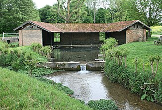
Orvanne
| Orvanne | ||
|
Source of the Orvanne |
||
| Data | ||
| Water code | FR : F4398000 | |
| location | France , Bourgogne-Franche-Comté and Île-de-France regions | |
| River system | His | |
| Drain over | Loing → Seine → English Channel | |
| source | in the municipality of Saint-Valérien, 48 ° 11 ′ 1 ″ N , 3 ° 6 ′ 45 ″ E |
|
| Source height | approx. 152 m | |
| muzzle | at Moret-sur-Loing in the Loing coordinates: 48 ° 22 ′ 40 " N , 2 ° 49 ′ 7" E 48 ° 22 ′ 40 " N , 2 ° 49 ′ 7" E |
|
| Mouth height | approx. 45 m | |
| Height difference | approx. 107 m | |
| Bottom slope | approx. 2.7 ‰ | |
| length | 39 km | |
The Orvanne is a river in France that runs through the Bourgogne-Franche-Comté and Île-de-France regions. It rises in the municipality of Saint-Valerien , generally drained northwest and flows for 39 kilometers at Moret-sur-Loing as a right tributary of the Loing . In the area of the mouth it runs parallel to the Canal du Loing , which accompanies the Loing here as a side canal and only flows below the last lock. On its way, the Orvanne touches the Yonne and Seine-et-Marne departments .
Places on the river
Web links
Commons : Orvanne - collection of images, videos and audio files
