Blennes
| Blennes | ||
|---|---|---|
|
|
||
| region | Île-de-France | |
| Department | Seine-et-Marne | |
| Arrondissement | Provins | |
| Canton | Nemours | |
| Community association | Pays de Montereau | |
| Coordinates | 48 ° 15 ′ N , 3 ° 1 ′ E | |
| height | 98-162 m | |
| surface | 20.29 km 2 | |
| Residents | 559 (January 1, 2017) | |
| Population density | 28 inhabitants / km 2 | |
| Post Code | 77940 | |
| INSEE code | 77035 | |
| Website | http://www.blennes.fr/ | |
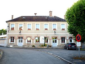
 City Hall (Mairie) of Blennes |
||
Blennes is a French municipality with 559 inhabitants (as of January 1 2017) in the department of Seine-et-Marne in the region Ile-de-France . It belongs to the Arrondissement Provins and the canton of Nemours (until 2015: canton of Lorrez-le-Bocage-Préaux ). The inhabitants are called Blennois .
geography
Blennes is located about 83 kilometers south-southeast of Paris on the Orvanne . Neighboring municipalities of Blennes are Diant in the north, Villethierry in the east and northeast, Vallery in the east, Chéroy in the south and southeast, Vaux-sur-Lunain in the southwest and Chevry-en-Sereine in the west.
Population development
| year | 1962 | 1968 | 1975 | 1982 | 1990 | 1999 | 2006 | 2013 |
| Residents | 374 | 321 | 279 | 261 | 331 | 477 | 541 | 566 |
| Source: Cassini and INSEE | ||||||||
Attractions
See also: List of Monuments historiques in Blennes
- Saint-Victor church from the 12th century, later additions and alterations, monument historique since 1942
Community partnerships
There is a partnership with the German municipality of Starzach in Baden-Württemberg.
Personalities
- Michel Vianey (1930–2008), writer and journalist
literature
- Le Patrimoine des Communes de la Seine-et-Marne. Flohic Editions, Volume 1, Paris 2001, ISBN 2-84234-100-7 , pp. 665-666.
Web links
Commons : Blennes - collection of images, videos and audio files
- Blennes at annuaire-mairie.fr (French)

