Pöbbeckenmühle (Lutter am Barenberge)
|
Pöbbeckenmühle
Coordinates: 51 ° 57 '43 " N , 10 ° 13' 48" E
|
|
|---|---|
| Height : | approx. 180 m above sea level NN |
| Postal code : | 38729 |
| Area code : | 05383 |
|
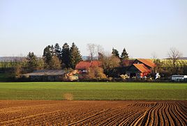
View of the Pöbbeckenmühle from the west
|
|
The Pöbbeckenmühle belongs to the district of Nauen in the Lutter am Barenberge patch , which is part of the Lutter am Barenberge municipality in the Goslar district in Lower Saxony.
geography
The Pöbbeckenmühle is a little more than one and a half kilometers south of the village of Nauen on the southwest slope of the Nauer Berg ridge in the Lutter basin on the Neile , a tributary of the Innerste . A few kilometers southeast of the mill is the Harz border .
Are located in the surrounding area in the northeast of the hamlet Rhode in the south-southwest of the place Hahausen , in southern New pitcher , west Jerze and east-southeast of the city Langelsheim .
A few hundred meters south-east of the Pöbbeckenmühle surrounded by fields are two former fish ponds with a small forest area, wet meadows and pastureland, which together form the Pöbbeckenmühle nature reserve .
history
As early as 1536, a water mill for the beginning of the 16th century is mentioned at the current location. Presumably, however, it was destroyed between 1519 and 1523 during the Hildesheim collegiate feud . In any case, this mill has demonstrably no longer existed since 1548 at the latest.
In 1609 the Pöbbeckenmühle was built at the same location by the then head forester Andreas Koch to supply the people of the house with flour. The approval for this was given a year earlier by Duke Heinrich Julius . During the Battle of Lutter am Barenberge in August 1626, the mill was largely destroyed 17 years after it was built.
In 1696 the location of the mill changed hands, and in 1700 he received permission to rebuild it. In the period that followed, various tenants managed the Pöbbeckenmühle. In 1829 the mill finally passed into the possession of the Gerber family, who operated the mill until after the Second World War. After the end of the First World War, an oil mill was built in addition to the grain mill in 1918. However, their operation lasted only a few years. During this period and in the following years, the owners ran an agricultural business on the same site and a fish farm with two ponds that also belonged to the Pöbbeckenmühle, in addition to the mill, which was driven by artificial ditches from a total of four streams.
A few years after the Second World War, the mill was finally shut down. However, the agricultural operation on the site continues to this day.
Population development
| Pöbbeckenmühle - population development 1774–1939 | ||
|---|---|---|
| year | Residents | development |
| 1774 | 7th |
 |
| 1798 | 8th | |
| 1885 | 8th | |
| 1905 | 8th | |
| 1939 | 3 | |
Economy and Infrastructure
Transport links
The Pöbbeckenmühle is located on the state road 594, which connects Jerze and Bornum in the west with the federal roads 248 and 82 in the east and south. This means that the federal autobahn 7 , Goslar , Seesen and Salzgitter-Bad can be reached in a short time.
swell
To the history section : Kalthammer, Wilhelm: Die Chronik von Hahausen ; Druckerei M. Wirth GmbH, Hahausen 1983 (p. 180/181)
(published on www.hahausen-harz.de : The Chronicle of Hahausen. Section: The Pöbbeckenmühle ).


