Pijao
| Pijao | ||
|---|---|---|
|
Coordinates: 4 ° 20 ′ N , 75 ° 42 ′ W Pijao on the map of Colombia
|
||
|
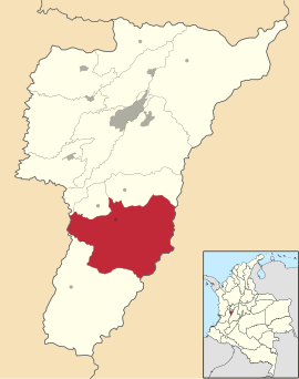
Location of Pijao in Quindío
|
||
| Basic data | ||
| Country | Colombia | |
| Department | Quindío | |
| City foundation | 1902 | |
| Residents | 5940 (2019) | |
| City insignia | ||
| Detailed data | ||
| surface | 243 km 2 | |
| Population density | 24 people / km 2 | |
| height | 1700 m | |
| Time zone | UTC -5 | |
| City Presidency | Edinson Aldana Martínez (2016-2019) | |
| Website | ||
| Central park in Pijao | ||
Pijao is a municipality ( municipio ) in the department of Quindío in Colombia's coffee-growing region (eje cafetero) .
geography
Pijao is at an altitude of about 1700 m above sea level. NN 31 km south of Armenia and has an average annual temperature of 19 ° C. Pijao borders in the north on Calarcá , Buenavista and Córdoba , in the south on Génova , in the east on Cajamarca and Roncesvalles in the department of Tolima and in the west on Caicedonia in the department of Valle del Cauca .
population
The municipality of Pijao has 5940 inhabitants, of which 3614 live in the urban part (cabecera municipal) of the municipality (as of 2019).
history
Pijao was founded in 1902 with the name San José de Colón . Since 1926 the place has the status of a municipality. In 1931 the name was changed to Pijao, named after the Pijaos , an indigenous people of the Caribs who - originally immigrated from the Orinoco region - lived in what is now the Tolima Department and in the area of today's municipality and in the mestizo there before the arrival of the Spaniards -Population rose.
economy
The main industry of Pijao is agriculture , especially the cultivation of coffee . In addition to bananas and cassava grown. In addition, the plays cattle and milk production an important role.
Web links
- Alcaldia Municipal de Pijao. Alcaldía de Pijao - Quindío, accessed April 15, 2019 (Spanish, municipality website).
Individual evidence
- ↑ a b c Nuestro municipio. Alcaldía de Pijao - Quindío, accessed April 15, 2019 (Spanish, information on the municipality).
- ↑ ESTIMACIONES DE POBLACIÓN 1985 - 2005 Y PROYECCIONES DE POBLACIÓN 2005 - 2020 TOTAL DEPARTAMENTAL POR ÁREA. (Excel; 1.72 MB) DANE, May 11, 2011, accessed on April 15, 2019 (Spanish, extrapolation of the population of Colombia).


