
Plaridel (Bulacan)
| Municipality of Plaridel | |||
| Location of Plaridel in the province of Bulacan | |||
|---|---|---|---|

|
|||
| Basic data | |||
| Region : | Central Luzon | ||
| Province : | Bulacan | ||
| Barangays : | 19th | ||
| District: | 2. District of Bulacan | ||
| PSGC : | 031417000 | ||
| Income class : | 1st income bracket | ||
| Households : |
May 1, 2000 census
|
||
| Population : | 107,805 August 1, 2015 census
|
||
| Population density : | 3323 inhabitants per km² | ||
| Area : | 32.44 km² | ||
| Coordinates : | 14 ° 53 ' N , 120 ° 51' E | ||
| Postal code : | 3004 | ||
| Website: | Plaridel on the website of the Bulacan Province | ||
| Geographical location in the Philippines | |||
|
|||

Plaridel , Tagalog : Bayan ng Plaridel , is a Filipino municipality in the province of Bulacan , in the administrative region III, Central Luzon . According to the 2015 census, Plaridel had 107,805 residents who lived in 19 barangays . It is classified as the first income class community in the Philippines and as urbanized .
Plaridel`s neighboring communities are Pulilan and Baliuag in the north, Bustos in the northeast, Pandi in the east, Balagtas in the southeast, Malolos City and Guiguinto in the south and Calumpit in the west. The topography of the city is characterized by the plains of the central Luzon lowlands.
Barangays
|
|
Web links
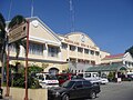
City Hall (Pamahalaang Bayan ng Plaridel, Poblacion)
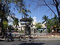
Mayor Jose J. Mariano (1934–1950) Park (Poblacion)

Tower of Plaridel Airport

Church in Plaridel

Public Market Hall (Poblacion)

La Consolacion University Hospital


