
Prislop Pass
| Prislop Pass | |||
|---|---|---|---|
 View of the Prislop Pass in summer |
|||
| Compass direction | northwest | Southeast | |
| Pass height | 1413 m | ||
| region | Maramureş Maramures County | Suceava Bucovina district | |
| Watershed | Râul Vişeu → Tisza | Bistrița → Sereth | |
| Valley locations | Borșa | Cârlibaba | |
| expansion | Street | ||
| Mountains | Rodna Mountains , Eastern Carpathians | ||
| particularities | highest mountain pass in the Romanian Eastern Carpathians | ||
| Map (Romania) | |||
|
|||
| Coordinates | 47 ° 36 '33 " N , 24 ° 51' 16" E | ||

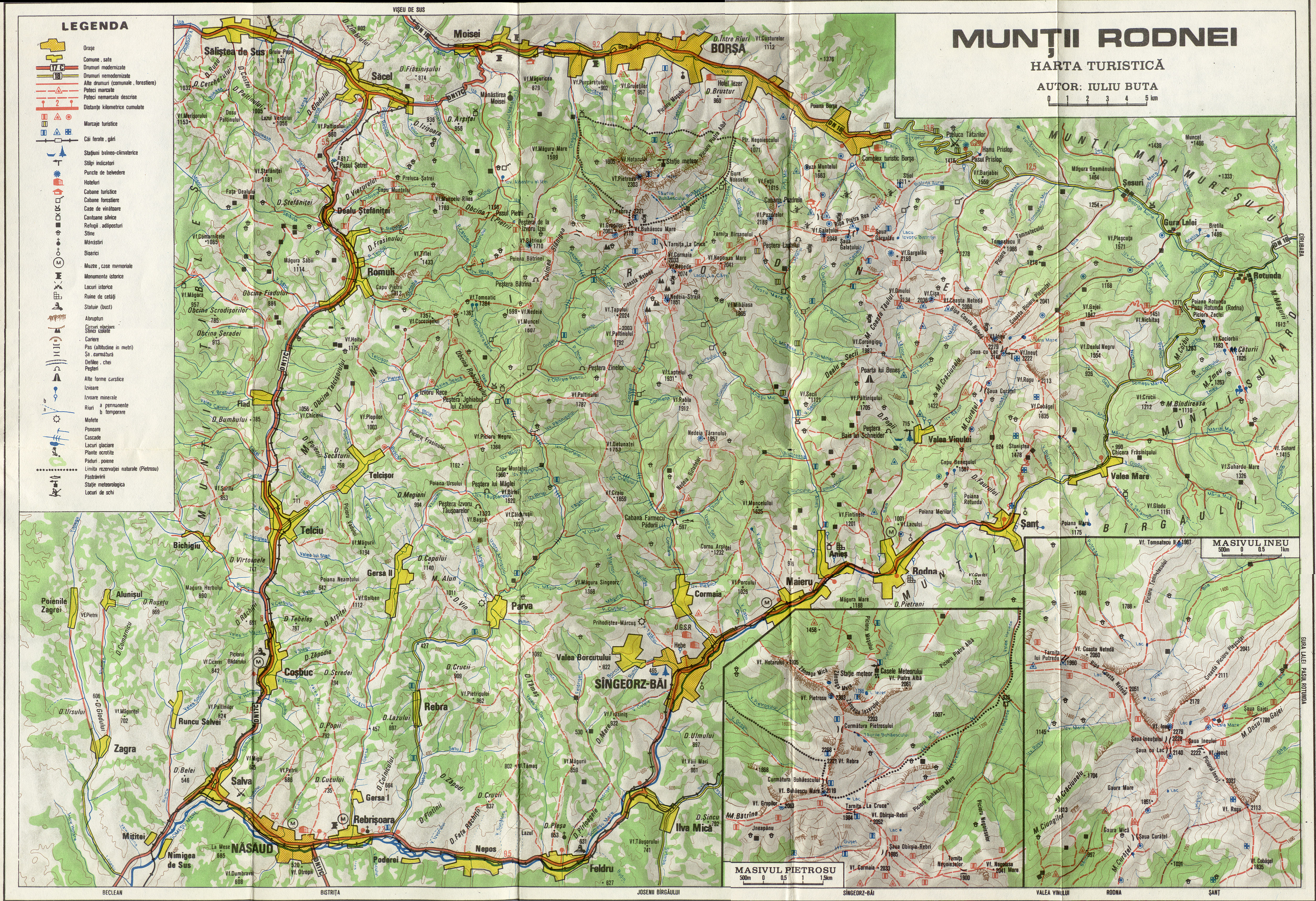
The Prislop Pass ( Romanian Pasul Prislop ) is a mountain pass in the Romanian Eastern Carpathians near the border with Ukraine , at an altitude of 1416 m .
The Prislop Pass is also called the Stiol Pass because of the 1611 meter high Stiol mountain in the Rodna Mountains ( Munții Rodnei ) .
Location and surroundings
_%26_Tihu%C8%9Ba-_(bzw._Borgo)-Pass.jpg)
In northern Romania, the approximately 50-kilometer pass delimits the Rodna Mountains in the north from the Maramureș Mountains (Munții Maramureșului) in the south. The Prislop Pass connects the small town of Borșa in Maramureș County , with the municipality of Cârlibaba in Suceava County in the historical region of Bucovina, 53 kilometers southeast . The mountain pass is part of the 221 kilometer long national road Drum național 18 which runs from Baia Mare via Sighetu Marmației , Vişeu de Sus (Oberwischau) via Borşa to Iacobeni - a municipality in the Suceava district.
From Borșa the Prislop Pass runs along the upper reaches of the Vișeu and from the highest point on the so-called Munți Prislop , which also forms the watershed between Tisza and Sereth , along the Bistrița in a south-easterly direction.
At the highest point of the Prislop Pass, near the roadway, there is a monastery, a heroes' cemetery and a memorial in honor of the soldiers who fell here in World War I. Because of the religious affiliation of the monastery Sfânta Treime and Schimbarea la Fa Kloă , the construction of which began in 1999, disputes between the Orthodox and the Greek Catholic Church are repeatedly waged.
Traffic situation
The north-west side of the pass is relatively steep, but the south-east connection stretches over a longer stretch of gentle hills. In autumn 2013 the road surface was in poor condition, this should be fixed by 2014. The appointment could not be kept. In October 2015, driving on the Prisloppass road is still associated with risks because of the deep potholes.
In the winter months, the pass road is often blown by large amounts of snow, so that traffic is severely hindered.
tourism
In winter the pass is closed and covered with a thick layer of snow. In summer, on the other hand, it is a popular destination for many tourists on their journey through the Carpathian Mountains . The panoramic view extends from the peaks of the Rodna Mountains with the Ineu and Pietros mountains to the upper reaches of the Bistrița river . The Hora de la Prislop festival has been held here since 1968 .
Web links
- Pictures and short descriptions of the Prislop Pass at romaniaphotos.ro (English)
- Pasul Prislop at alpinet.org (Romanian)
Individual evidence
- ↑ Map of the Rodna Mountains at tenereclub.ro
- ^ Official Journal of Romania on the website of the Romanian Society for Motorways and National Roads ( Memento of November 9, 2014 in the Internet Archive ), accessed on November 11, 2014 (Romanian).
- ^ Image of the Heroes' Cemetery at Prislop Monastery
- ↑ Information on the Prislop Monastery on the website of the city of Borșa, accessed on February 6, 2020 (Romanian).
- ↑ Mănăstirea din Pasul Prislop, motiv de conflict între două confesiuni , at jurnalmm.ro, accessed on February 6, 2020 (Romanian).
- ↑ The Prislop is almost not passable , accessed on October 30, 2013 from stiri.tvr.ro on November 11, 2014 (Romanian)