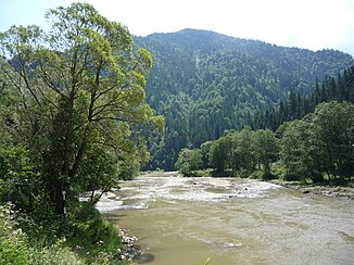
Bistrița (Sereth)
|
Bistrița Bistrița Aurea (upper reaches) |
||
|
Bistrița near Vatra Dornei |
||
| Data | ||
| location | Districts of Maramureș , Bistrița-Năsăud , Suceava , Neamț , Bacău ( Romania ) | |
| River system | Danube | |
| Drain over | Sereth → Danube → Black Sea | |
| source | east of Borșa in the Rodna Mountains 47 ° 40 ′ 10 ″ N , 24 ° 53 ′ 5 ″ E |
|
| Source height | 1649 m | |
| muzzle | At Nicolae Bălcescu ( Bacau district ) in the Sereth coordinates: 46 ° 29 ′ 32 ″ N , 26 ° 58 ′ 7 ″ E 46 ° 29 ′ 32 ″ N , 26 ° 58 ′ 7 ″ E |
|
| Mouth height | 134 m | |
| Height difference | 1515 m | |
| Bottom slope | 5.2 ‰ | |
| length | 290 km | |
| Catchment area | 6974 km² | |
| Drain |
MQ |
66 m³ / s |
| Left tributaries | Cârlibaba , Cracau | |
| Right tributaries | Dorna , Neagra Șarului , Bicaz | |
| Reservoirs flowed through | Izvorul Muntelui | |
| Big cities | Piatra Neamț , Bacau | |
| Small towns | Vatra Dornei , Broşteni , Bicaz , Buhuşi , Roznov | |
|
The Bistrița in Romania |
||
The Bistrița ( German Bistritz or Bistritza ) is a right tributary of the Sereth in Romania .
It rises as Bistrița Aurie ("Golden Bistritz") in the Rodnaer Mountains (Rum. Munții Rodnei , Hungarian Radnai-havasok ) and flows through the entire breadth of the Eastern Carpathians in the Moldau region (Rum. Moldova ), crosses a piece of the former Bukowina and then flows below Bacău from the right into the Sereth, which in turn flows into the Danube at Galați and this a little later into the Black Sea . The river has a length of 290 km, a catchment area of 6974 km² and (shortly from its confluence with the Sereth) a water flow of 66 m³ / s. In the course of the river is the Izvorul Muntelui reservoir , which was built between 1950 and 1960 and covers an area of 33 km².
See also
- Bistrița (Șieu)
- List of rivers in Romania
- Body name, field name and place name Bystritza

