
Maramureș County


Maramureș [ maramureʃ ] ( , German Maramuresch , Marmarosch , Hungarian Máramaros ) is a Romanian district ( Județ ) in northern Romania with the district capital Baia Mare . Its common abbreviation and the license plate are MM.
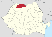
The Maramureş County borders in the north and in the north-east to the Ukraine , in the east of the Suceava County , in the southeast of the county Bistrita-Nasaud , in the south of the circles Cluj and Salaj and in the west of the county of Satu Mare .
Demographics
In 2002 the district of Maramureș had 510,110 inhabitants and a population density of 81 inhabitants per km², in 2011 it had 478,659 inhabitants, thus a population density of 76 inhabitants per km².
geography
The district has a total area of 6304 km². It only partially corresponds to the historical region of Maramures . On the one hand, the northern part of this region is now in Ukraine . On the other hand, some communities in the south around the city of Târgu Lăpuș ( Țara Lăpușului landscape ) and thus areas from the historical region of Transylvania belong to the Maramureș district today. The entire southwest of the district - beyond the Gutâi Mountains - with the district capital Baia Mare was not part of Maramures in the past, but rather part of the Sathmar region . The Huta pass connects the two districts of Maramureș and Satu Mare ( Hungarian Szatmár ). The 1334 km² nature park of the Maramures Mountains lies in the district .
Rivers
cities and communes
The Maramureș County officially consists of 246 localities. Of these, 13 have the status of a city , 63 that of a municipality. The rest are administratively assigned to the cities and municipalities.
Biggest places
| City / municipality | population |
|---|---|
| Baia Mare ( German Neustadt or Frauenbach , Hungarian Nagybánya ) | 123,738 |
| Sighetu Marmației (German Marmaroschsiget , Hungarian Máramarossziget ) | 37,640 |
| Borșa (German Borscha , Hungarian Borsa ) | 27,611 |
| Baia Sprie (German Mittelstadt , Hungarian Felsőbánya ) | 15,476 |
| Vișeu de Sus (German Oberwischau , Hungarian Felsővisó ) | 15,037 |
| Târgu Lăpuș (German Laposch , Hungarian Magyarlápos ) | 11,744 |
| Poienile de sub Munte ( Ger . Reußenau , Hungarian Ruszpolyána , uk. Русь Поляни ) | 10,073 |
| Moisei (German Mosesdorf , Hungarian Majszin ) | 9,264 |
| Seini (German Leuchtenburg , Hungarian Szinérváralja ) | 8,987 |
| Șomcuta Mare (German great horn , Hungarian Nagysomkút ) | 7,565 |
| Ulmeni (German Ulmendorf , Hungarian Sülelmed ) | 7,270 |
| Tăuții-Măgherăuș (Hungarian Miszmogyorós ) | 7.136 |
| Recea (Hungarian Lévárdfalva ) | 6,000 |
| Satulung (Hungarian Kővárhosszúfalu ) | 5,837 |
| (As of October 20, 2011) | |
Worth seeing
- The Vișeu de Sus Wassertalbahn , a narrow-gauge railway operated by steam locomotives .
- In 1999, UNESCO named the wooden churches in Maramureș a World Heritage Site .
See also
Web links
- Maramureș County Council website
- The Maramureș, on www.karpatenwilli.com
- About the Maramureș, by Björn & Florentina Reinhardt
- Maps of Maramureș County: [1] ; [2]
Individual evidence
- ↑ a b 2011 census in Romania at citypopulation.de
Alba | Arad | Argeș | Bacau | Bihor | Bistrița-Năsăud | Botoșani | Brăila | Brașov | Bucureşti | Buzău | Călărași | Caraș-Severin | Cluj | Constanța | Covasna | Dâmbovița | Dolj | Galați | Giurgiu | Gorj | Harghita | Hunedoara | Ialomița | Iași | Ilfov | Maramureș | Mehedinți | Mureș | Neamț | Olt | Prahova | Sălaj | Satu Mare | Sibiu | Suceava | Teleorman | Timiș | Tulcea | Vâlcea | Vaslui | Vrancea
Coordinates: 47 ° 40 ' N , 24 ° 0' E