Protwa
|
Protwa Протва́ |
||
|
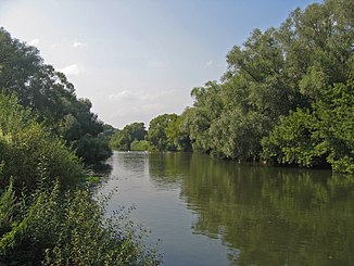
The Protva near Obninsk in summer |
||
| Data | ||
| Water code | RU : 09010100612110000021991 | |
| location | Moscow Oblast , Kaluga ( Russia ) | |
| River system | Volga | |
| Drain over | Oka → Volga → Caspian Sea | |
| source |
Moscow ridges 55 ° 26 ′ 57 ″ N , 35 ° 26 ′ 24 ″ E |
|
| muzzle | west of Serpuchow in the Oka coordinates: 54 ° 50 ′ 51 ″ N , 37 ° 16 ′ 24 ″ E 54 ° 50 ′ 51 ″ N , 37 ° 16 ′ 24 ″ E
|
|
| length | 282 km | |
| Catchment area | 4620 km² | |
| Drain |
MQ |
25 m³ / s |
| Right tributaries | Luscha | |
| Big cities | Obninsk | |
| Medium-sized cities | Balabanowo , Protvino | |
| Small towns | Verya , Borovsk | |
|
Location of the Protwa (Протва́) in the catchment area of the Oka |
||
Protwa ( Russian Протва́ ) is a 282-kilometer-long left tributary of the Oka , which flows through the Moscow and Kaluga oblasts in Russia . The river basin covers around 4620 square kilometers. The water regularly freezes over in December and remains icy until early April. The main tributary is the Luscha .
The largest towns along the Protva are Wereja , Borovsk , Protvino and Obninsk .
Web links
Commons : Protwa - collection of images, videos and audio files


