
Puerto Plata (Province)
| Puerto Plata | ||
|---|---|---|
  |
||
| Symbols | ||
|
||
| Basic data | ||
| Country | Dominican Republic | |
| region | Cibao Norte | |
| Seat | Puerto Plata | |
| surface | 1,805.6 km² | |
| Residents | 321,597 (2010) | |
| density | 178 inhabitants per km² | |
| ISO 3166-2 | DO-18 | |

Coordinates: 19 ° 44 ′ N , 70 ° 47 ′ W

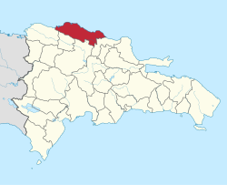
Puerto Plata is a province in the north of the Dominican Republic . The province is nestled between the mountains of the Cordillera Septentrional and the Atlantic Ocean. The coast offers numerous sandy beaches and breathtaking views of the Atlantic .
In 1907 the province of Puerto Plata was separated from the capital of the same name.
economy
Mainly coffee , cocoa and sugar cane are grown in the province . However, agriculture has been replaced by tourism as the main economic activity since the late 1990s . The province is one of the most important tourist destinations in the Dominican Republic.
Major cities and towns
- Puerto Plata , provincial capital
- Altamira
- Cabarete
- Imbert
- La Isabela
- Luperón
- Sosúa
Azua | Baoruco | Barahona | Dajabón | Duarte | El Seibo | Elías Piña | Espaillat | Hato Mayor | Hermanas Mirabal | Independencia | La Altagracia | La Romana | La Vega | María Trinidad Sánchez | Monseñor Nouel | Monte Cristi | Monte Plata | Pedernales | Peravia | Puerto Plata | Samaná | San Cristóbal | San José de Ocoa | San Juan | San Pedro de Macorís | Sánchez Ramírez | Santiago | Santiago Rodríguez | Santo Domingo | Valverde