
Punakha (District)
| Punakha district | |
|---|---|
  |
|
| Basic data | |
| Country | Bhutan |
| Capital | Punakha |
| surface | 1108 km² |
| Residents | 28,740 (2017) |
| density | 26 inhabitants per km² |
| ISO 3166-2 | BT-23 |
 |
|
Coordinates: 27 ° 42 ' N , 89 ° 48' E
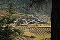
Punakha ( སྤུ་ ན་ ཁ་ རྫོང་ ཁག ) is one of the 20 districts ( dzongkhag ) of Bhutan . About 26,541 people (2012) live in this district. The Punakha area covers 1108 km².
The capital of the district is of the same name Punakha .
The Punakha district is in turn divided into 11 Gewogs :
- Barp Weighed
- Chhubu Weighed
- Dzomo Weighed
- Goenshari Weighed
- Guma Weighed
- Kabjisa Weighed
- Lingmukha Weighed
- Shenga Bjime Weighed
- Talo Weighed
- Toepisa Weighed
- Toewang Weighed
gallery
- Punakha (District)

Punakha

Dzong

Lobesa

Sopsokha
Yowakha

Chime Lhakhang


Web links
Commons : Punakha District - Collection of images, videos and audio files

Bumthang | Chukha | Dagana | Gasa | Haa | Lhuntse | Mongar | Paro | Pemagatshel | Punakha | Samdrup Jongkhar | Velvet | Sarpang | Thimphu | Trashigang | Trashiyangtse | Trongsa | Tsirang | Wangdue Phodrang | Zhemgang