
Trashigang (District)
| Trashigang District | |
|---|---|
  |
|
| Basic data | |
| Country | Bhutan |
| Capital | Trashigang |
| surface | 3,066.9 km² |
| Residents | 53,293 (2012) |
| density | 17 inhabitants per km² |
| ISO 3166-2 | BT-41 |
 |
|
Coordinates: 27 ° 18 ' N , 91 ° 42' E
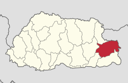
Trashigang ( བཀྲ་ ཤིས་ སྒང ) is one of the 20 districts of Bhutan . About 53,293 people live in this district (2011). The Trashigang area covers 3,066.9 km².
The capital of the district is the Trashigang of the same name .
The Trashigang district is in turn divided into 15 Gewogs :
- Bartsham Weighed
- Biden weighed
- Kanglung Weighed
- Kangpara Weighed
- Khaling Weighed
- Lumang Weighed
- Merak Weighed
- Phongmey Weighed
- Radhi Weighed
- Files Weighed
- Samkhar Weighed
- Shongphu Weighed
- Thrimshing Weighed
- Uzorong Weighed
- Yangneer Weighed
economy
Rice and lavender are the main agricultural products in the Trashigang district . The district was part of the important trade route between Assam and Tibet and is still an important link in economic trade with India . Yongphulla Airport is located in the district .
Web links

Bumthang | Chukha | Dagana | Gasa | Haa | Lhuntse | Mongar | Paro | Pemagatshel | Punakha | Samdrup Jongkhar | Velvet | Sarpang | Thimphu | Trashigang | Trashiyangtse | Trongsa | Tsirang | Wangdue Phodrang | Zhemgang