Querfurt plate
| Querfurt plate | ||
|---|---|---|
| Highest peak | Barnstädter Huthügel ( 244.6 m above sea level ) | |
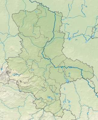
| location | Saalekreis , Mansfeld-Südharz , Burgenlandkreis ; Saxony-Anhalt ( Germany ) | |
| part of | Querfurt Plate and Lower Unstrut Plate , Thuringian Basin (with edge plates) | |
| Classification according to | Handbook of the natural spatial structure of Germany | |
|
|
||
| Coordinates | 51 ° 19 ′ N , 11 ° 38 ′ E | |
| rock | Shell limestone | |
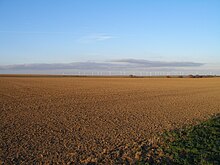
The Querfurter Platte is up to 244.6 m above sea level. NHN high landscape in the Saalekreis , Mansfeld-Südharz and Burgenlandkreis in Saxony-Anhalt . It is named after the small town of Querfurt , which lies in the northern part of the Platte.
geography
location
The Querfurter Platte is bounded by the Hornburger Sattel in the northwest, the Geiseltal in the east and the Unstrut valley near Nebra in the south and the red sandstone plate of the Ziegelrodaer Forest in the west. Similar to the Mansfelder Platte in the north-northwest, it is an undulating plateau with altitudes between 120 and 244.6 m .
Surveys
The elevations of the Querfurter Platte include - sorted by height in meters (m) above mean sea level (NHN):
- Barnstädter Huthügel (244.6 m), south of Barnstädt , Saalekreis
- Wedenberg (241.6 m), north of Farnstädt , Saalekreis
- Langer Berg (240.8 m), west of Müncheroda , Burgenlandkreis
- nameless hilltop? (238.9 m), west of Barnstädt, Saalekreis
- Galgenberg (225.8 m), west of Querfurt , Saalekreis
Natural allocation
Within the natural spatial main unit group Thuringian Basin (with edge plates) (48), the Querfurter Platte belongs to the main unit Querfurter Platte and Untere Unstrutplatten (No. 489).
Geology and nature
Due to the geological conditions, the location in the central German dry area and the intensive agriculture, the Querfurt Platte is characterized by minimal surface drainage and a low river density.
The Querfurter Platte is one of the largest loess - black earth areas in Saxony-Anhalt. The soils have a high yield potential. The landscape is shaped by the intensive agriculture and is accordingly poor in structure. Large-scale fields in an open agricultural landscape are decisive. Structural elements such as small trees, hedges, field margins and rows of trees are only present in small numbers.

The underground rock ( shell limestone ) as well as the thick loess layers above it cause a slightly agitated relief. The flat, undulating morphology of the landscape causes diverse accumulation and erosion processes. In the west and south the plateau, which slopes gently to the east, ends with a steep step.
Due to the wind speed , several wind farms have been created in the area of the Querfurter Platte in recent years.
climate
The climatic conditions are determined by the location in the central German dry area. The average annual precipitation is around 500 mm ( Querfurt : 488 mm), the average annual temperature is 8 to 9 ° C ( Bad Lauchstädt : 8.8 ° C).
Individual evidence
- ↑ Map services of the Federal Agency for Nature Conservation ( information )
- ^ Emil Meynen , Josef Schmithüsen (editor): Handbook of the natural spatial structure of Germany . Federal Institute for Regional Studies, Remagen / Bad Godesberg 1953–1962 (9 deliveries in 8 books, updated map 1: 1,000,000 with main units 1960).
Web links
- Landscape profile Querfurter Platte and Untere Unstrutplatten , Federal Agency for Nature Conservation, on bfn.de

