
Goat light
| Goat light | ||
|---|---|---|
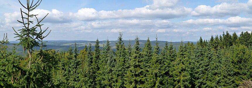
 Wallershöhe (left) and Ziegenhelle (right) from the northeast, taken from the Bollerbergturm |
||
| height | 816.1 m above sea level NHN | |
| location | close Züschen ; Hochsauerlandkreis , North Rhine-Westphalia ( Germany ) | |
| Mountains | Hochsauerland ( Rothaar Mountains ) | |
| Dominance | 6.3 km → southern flank Kahler Asten | |
| Notch height | 170.5 m ↓ Mollseifen | |
| Coordinates | 51 ° 7 '32 " N , 8 ° 31' 47" E | |
|
||
| particularities | Ziegenhellenturm ( AT ) | |


The goat light near Züschen is 816.1 m above sea level. NHN high mountain of the Rothaargebirge in the North Rhine-Westphalian Hochsauerlandkreis ( Germany ). It forms the center of a star-shaped mountain range, up to 12 km in east-northeast direction and up to 7 km in south-southeast direction, which extends far to the southwest into the Siegen-Wittgenstein district , and is one of the most extensive peaks in the Sauerland and Rothaar Mountains. This mountain range forms the Ziegenhelle (natural area) natural area Ziegenhelle .
The Ziegenhellenturm observation tower is located near the mountain top . The Snow World Züschen winter sports area is located on the northern mountain slopes .
geography
location
The Ziegenhelle is located in the Hochsauerland , the highest part of the Rothaargebirge. It rises in the Sauerland-Rothaargebirge nature park about 4 km southwest of Züschen , a district of Winterberg . The Ahre rises northwest of its crest , the Nuhne tributary streams southeast of the crest and the Schwarzenau on its southwest flank . The Snow World Züschen winter sports area extends north-east of the Ziegenhelle, over whose summit a cross-country ski run leads . About 20 m northwest of the summit ( 815.9 m ) there is a trigonometric point at a height of 815.5 m .
Natural allocation
The goat light is naturally allocated as follows:
-
(to 33 Süderbergland )
-
(to 333 Rothaar Mountains)
-
(to 333.5 Winterberger Hochland)
- 333.51 Ziegenhelle (natural area)
-
(to 333.5 Winterberger Hochland)
-
(to 333 Rothaar Mountains)
Mountains and peaks of the natural area
About 850 m south of the Ziegenhelle summit is its 812.1 m high second summit Wallershöhe . From these central elevations, various mountain ridges branch off in a star-shaped radius of 4 to 6 km, all of which are still part of the Ziegenhellen massif. A Vertical separation of more than 50 m exhibit only the cornerstones discord Berg (747.0 m, NW), Hackelberg (690.5 m, NO), Hundsrücken / Heidkopf (698.4 and 704.1 m, double piers, SO) and Homburg ( 721.8 m, SW), with the Zwistberg also having the highest dominance with 2.6 km, followed by the Homburg and the Heidkopf, which is equipped with a lookout tower and, as the only mountain in the Medebach Bay, directly faces a submontane natural area.
The main ridge on the Obereder-Mitteleder watershed leads from the Zwistberg in the northwest via Ziegenhelle and Wallershöhe to the 766.6 m high Hasselback , the third highest elevation of the massif, beyond which the western watershed of the Nuhne in the Wilden Struth and, at the same time, only 674 in Hesse , 6 m ( Lippestriesch ) and 669.1 m ( Kleiner Hoher Stein ) before finally disappearing into the flat undulating Medebacher Bay near Bromskirchen .
For an almost complete list, see the corresponding section in the natural space article !
Protected areas
Large parts of the Ziegenhellen massif are under nature protection , from which the ridge area with Ziegenhelle and Wallershöhe is left out. See section in the natural space article !
Goat Hell Tower
Previous buildings
In 1881 a trigonometric point was set on the summit of the Ziegenhelle. For this purpose, a so-called setting stone was set and an 11 m high cadastral signal was erected. For the actual triangulation , a 19.2 m high surveying scaffold was built in place of the cadastral signal. This scaffolding was then used by the Sauerland Mountain Association (SGV) as a lookout tower.
On the initiative of the SGV department in Züschen , a new wooden observation tower was built in the 1930s because the old surveying framework was in ruins. This observation tower was demolished in 1973/74 because it was rotten. The then newly built Ziegenhellenturm , a 15 m high wooden observation tower, was then demolished in autumn 2010 because it was dilapidated.
Today's tower
A new lookout tower should be built by the end of 2009 with the help of EU funding; However, this was delayed until the summer of 2011. The construction of the new goat cellar tower was financed by the local home and tourist office (€ 30,000), EU funds and the city of Winterberg (€ 1,250). Of the construction costs of € 78,956.50, the city of Winterberg received € 29,000 as LEADER grants from the EU. The newly built wooden tower was inaugurated on July 30, 2011 and is located about 25 m west of the mountain peak. The approximately 14.7 m high tower stands on a square floor plan and has a roofed octagonal viewing platform at a height of 11.6 m. Even at the time of completion, the view options were severely restricted by the surrounding trees. A clearing for a better view is being considered. There is a wooden shelter next to the tower .

Summit region of the Ziegenhelle with a refuge and the old Ziegenhell tower from 1973/1974 (May 2009)

New goat bell tower from 2011
View from the Ziegenhelleturm towards Neuastenberg 2017


Traffic and walking
The summit of the Ziegenhelle can only be reached via farm and hiking trails. The nearest parking is located on the northern slope of the mountain at the ski resort Snow World Züschen and from between Züschen and Mollseifen running country road accessible by a paved access road 721st
The Mythen and Sagenweg, a 26 km long circular hiking trail that starts in Züschen and the 7th stage of the Sauerland-Höhenflug long-distance hiking trail , which leads from Altastenberg over the Ziegenhelle to Hallenberg, runs over the mountain .
The Ziegenhelle Uphill, which leads from Züschen to the summit of the Ziegenhelle, is a challenge for mountain bikers .
literature
- Hans Fröhlich (Ed.): As far as the eye can see: observation towers in the Sauerland and Siegerland. Woll Verlag, Schmallenberg 2012, ISBN 978-3-943681-06-2 .
Individual evidence
- ↑ a b c Topographical Information Management, Cologne District Government, Department GEObasis NRW ( information )
- ↑ Martin Bürgener: Geographical Land Survey: The natural spatial units on sheet 111 Arolsen. Federal Institute for Regional Studies, Bad Godesberg 1963. → Online map (PDF; 4.1 MB)
- ↑ Map services of the Federal Agency for Nature Conservation ( information )
- ↑ a b Article 130 years of the towers on the Ziegenhelle ( memento from May 8, 2014 in the Internet Archive ) by Hans Fröhlich and Walter Peis, Sauerland issue 4/2011
- ↑ As far as the eye can see: Lookout towers in the Sauerland and Siegerland , book by Hans Fröhlich (→ section literature )
- ↑ according to the project information that was previously available on leader-hochsauerland.de (accessed on November 16, 2009; PDF; 286 kB)
- ↑ Leader project in Züschen - New observation tower on the Ziegenhelle . Archived from the original on July 23, 2012 ; accessed on October 24, 2016 . , Press release of the WAZ media group on the new tower construction, dated August 26, 2009, accessed on July 8, 2015, on derwesten.de
- ↑ Tower inauguration date according to Ziegenhelle , on dl1dlf.de (amateur radio)
- ↑ Height information according to measurements carried out privately
- ↑ Information on possible clearing according to the article Beste Aussichten ( Memento from September 9, 2012 in the web archive archive.today ) from May 31, 2011, accessed on June 3, 2011, on sauerlandkurier.de
- ↑ The Myth and Legend Trail - adventure tour around Winterberg-Züschen ( Memento from September 30, 2017 in the Internet Archive ) on the website of Winterberg Touristik und Wirtschaft GmbH
- ↑ Ziegenhelle-Uphill ( memento from September 30, 2017 in the Internet Archive ) on the website of Winterberg Touristik und Wirtschaft GmbH