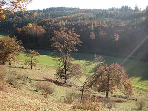
Röglinger Valley
| Röglinger Valley | ||
|---|---|---|
|
The Röglinger Valley near Liederberg |
||
| location | Bavaria , Germany | |
| Waters | Gailach | |
| Mountains | Franconian Alb | |
| Geographical location | 48 ° 51 '34 " N , 10 ° 57' 55" E | |
|
|
||
| climate | temperate, warm | |
| flora | Coniferous and mixed forests as well as open arable and pasture areas | |
| particularities | Border between Franconia , Swabia and Old Bavaria , the southernmost point of Franconia | |
The Röglinger Tal is a valley north of the eponymous Rögling , south of Langenaltheim and northwest of Mühlheim . The borders between the districts of Weißenburg-Gunzenhausen , Donau-Ries and Eichstätt and thus between the Bavarian administrative districts of Middle Franconia , Swabia and Upper Bavaria and between the cultural regions of Franconia , Swabia and Old Bavaria run through the valley . A stele marks the " border triangle ". At the same time, the southernmost point of Middle Franconia lies in the valley. The valley lies at the transition from the Weißenburger Alb to the Eichstätter Alb and the Monheimer Alb .
The Gailach , a right tributary of the Altmühl, flows through the valley . In summer the Gailach seeps completely underground below Warching , but in winter the runoff is so high that the stream can flow through the lower, normally dry valley to Mühlheim. In summer, the seeped water in the Gailach spring emerges again. A bike path, a hiking trail and the district road EI 3 / DON 21 run through the valley . To the north is the Oberholz forest area . The Röglinger Valley is situated in the Altmühltal Nature Park and surrounded by a landscape conservation area .
Individual evidence
- ↑ Dreiländereck in the Röglinger Tal ( Memento of the original from August 22, 2015 in the Internet Archive ) Info: The archive link was automatically inserted and not yet checked. Please check the original and archive link according to the instructions and then remove this notice. , www.diesteinreichen5.de, accessed on August 6, 2015
- ↑ Topographic maps , Bavarian Surveying Office ( BayernAtlas )

