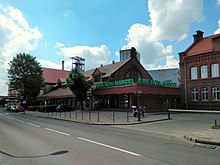
Radlin
| Radlin | ||
|---|---|---|

|
|
|
| Basic data | ||
| State : | Poland | |
| Voivodeship : | Silesia | |
| Powiat : | Wodzisław Śląski | |
| Area : | 12.53 km² | |
| Geographic location : | 50 ° 2 ′ N , 18 ° 29 ′ E | |
| Height : | 245 m npm | |
| Residents : | 17,776 (Jun. 30, 2019) |
|
| Postal code : | 44-310 | |
| Telephone code : | (+48) 32 | |
| License plate : | SWD | |
| Economy and Transport | ||
| Next international airport : | Katowice | |
| Gmina | ||
| Gminatype: | Borough | |
| Residents: | 17,776 (Jun. 30, 2019) |
|
| Community number ( GUS ): | 2415021 | |
| Administration (as of 2009) | ||
| Mayoress : | Barbara Magiera | |
| Address: | ul.Rymera 15 44-310 Radlin |
|
| Website : | www.radlin.pl | |
Radlin is a city of about 17,500 inhabitants in Poland . It is located eight kilometers north of Wodzisław Śląski and belongs to the powiat Wodzisławski , Silesian Voivodeship .
geography
City structure
The city of Radlin is divided into three districts:
- Biertułtowy (Birtultau)
- Głożyny (Glasin)
- Obszary (Obschory)
history

The village of Birtultau was first mentioned in 1305 as the Bertholdi villa . In the late 14th century, German settlers created other larger Waldhufendörfer such as Ober Radlin, Nieder Radlin and Glasin in the vicinity. In the 15th century there was an increased influx of the Polish population, so that both ethnic groups were about equally strong.
In 1742 the Silesian area came to Prussia . The discovery of hard coal in 1788 was followed by the start of mining, but initially only to a limited extent. With the Reden-Grube, established in Biertultau in 1840 and the Emma-Grube ( Kopalnia Marcel ) founded in Radlin in 1883 , coal mining gained importance. Together with the pits in Niedobschütz (Niedobczyce), Emma was the largest mine in the Rybnik district until 1896 .
In the period that followed, a coking plant , a briquette factory and several brick factories were built .
In 1922 the villages in Rybnik County became part of Poland. With the invasion of the Wehrmacht in 1939, they were reintegrated into Germany. In 1945, during the Second World War , a camp for Soviet prisoners of war was set up in Radlin, which was subordinate to the special command R 195 of the Wehrmacht . Several people were executed by the National Socialists in the disused shaft of the Reden mine .
Even after the end of the war, hard coal mining was the characteristic of Radlin, the Marcel mine ( Kopalnia Marcel ) employed 5,851 people in 1958.
On August 11, 1954, the places Radlin Górny (Upper Radlin), Radlin Dolny (Lower Radlin), Biertułtowy (Birtultau), Głożyny (Glasin) and Obszary (Obschory) were combined to form the city of Radlin. In 1975, the cities of Radlin, Pszów and Rydułtowy and the municipality of Marklowice were forced into the city of Wodzisław Śląski .
As a result of a citizens' referendum on January 1, 1997, the districts of Biertułtowy, Głożyny and Obszary were again spun off from Wodzisław Śląski and declared the city of Radlin. The former places Radlin Górny and Radlin Dolny, i.e. the actual Radlin, remained as the Radlin II district in Wodzisław.
Population development
1783: Ober and Nieder Radlin 279, Birtultau 87
1825: Ober and Nieder Radlin 667, Birtultau 279
1905: Ober and Nieder Radlin 3,789, Birtultau 1,908
1931: 8,900
1961: 17,462
1970: 20.334
sons and daughters of the town
- Bolesław Kominek (* 1903 in Radlin II; † 1974), Archbishop of Wroclaw
- Tomasz Sikora (* 1973 in Wodzisław Śląski), Polish biathlete, silver medal winner of the 2006 Winter Olympics in Turin
- Leszek Blanik - (* 1977 in Wodzisław Śląski ), Polish gymnast
Web links
- Website of the city of Radlin (Polish)
Individual evidence
- ↑ a b population. Size and Structure by Territorial Division. As of June 30, 2019. Główny Urząd Statystyczny (GUS) (PDF files; 0.99 MiB), accessed December 24, 2019 .


