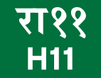
Rapti Rajmarg
| Highway H11 in Nepal | ||||||||||||||||||||||||||||
| Rapti Rajmarg राप्ती राजमार्ग |
||||||||||||||||||||||||||||

|
||||||||||||||||||||||||||||
| Basic data | ||||||||||||||||||||||||||||
| Operator: | Department of Roads | |||||||||||||||||||||||||||
| Start of the street: |
Musikot ( 28 ° 38 ′ N , 82 ° 27 ′ E ) |
|||||||||||||||||||||||||||
| End of street: |
Mahendra Rajmarg ( 27 ° 58 ′ N , 82 ° 13 ′ E ) |
|||||||||||||||||||||||||||
| Overall length: | 176 km | |||||||||||||||||||||||||||
|
Province: |
||||||||||||||||||||||||||||
|
Course of the road
|
||||||||||||||||||||||||||||
The Rapti Rajmarg ( Nepali राप्ती राजमार्ग ; English Rapti Highway ) is a north-south trunk road in the Rapti administrative zone in western Nepal .
The 176 km long country road branches off 75 km east of Kohalpur from Mahendra Rajmarg to the north. It leads from the river valley of the Western Rapti over the mountain ranges of the Front Himalayas to Tulsipur , where a side road branches off to the eastern district capital of Dang Deukhuri , Ghorahi . In the Salyan district , the Rapti Rajmarg follows the course of the Sharada Khola upstream and passes the cities of Sharada and Bagchaur . Eventually the highway turns north and reaches the district capital of Rukum , Musikot , where it ends.