Ribo
| Ribo | ||
|
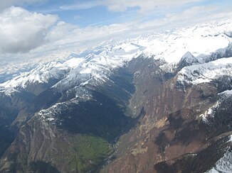
View of the Ribo Valley |
||
| Data | ||
| Water code | CH : 4742 | |
| location | Switzerland | |
| River system | Po | |
| Drain over | Isorno → Melezza → Maggia → Ticino → Po → Adria | |
| source | at Pizzo della Cavegna 46 ° 14 ′ 36 ″ N , 8 ° 28 ′ 49 ″ E |
|
| Source height | up to approx. 1892 m above sea level M. | |
| muzzle | between Crana and Russo in the Isorno coordinates: 46 ° 11 ′ 59 ″ N , 8 ° 37 ′ 0 ″ E ; CH1903: 690.93 thousand / 117 152 46 ° 11 '59 " N , 8 ° 37' 0" O |
|
| Mouth height | 631 m above sea level M. | |
| Height difference | 1261 m | |
| Bottom slope | 89 ‰ | |
| length | 14.1 km | |
| Catchment area | 57.29 km² | |
| Discharge at the mouth of the A Eo : 57.29 km² |
MQ Mq |
3.03 m³ / s 52.9 l / (s km²) |
| Left tributaries | Riale Boscaccio, Riale Quaranteria, Riale di Fümegn, Ri di Vergeletto, Ri di Quiello | |
| Communities | Onsernone | |
The Ribo is a 14.1 kilometer long left tributary of the Isorno in the Swiss canton of Ticino . It flows through the Valle di Vergeletto , a side valley of the Onsernone Valley , and drains an area of 57.3 square kilometers.
course
The Ribo rises on Pizzo della Cavegna on the border with Italy near Vergeletto and flows mainly in a south-easterly direction through the densely wooded Valle di Vergeletto. After the center of Vergeletto, about from the confluence of the Ri di Quiello , the Ribo makes an arc to the south and flows a little later between Crana and Russo from the left into the Isorno, of which it is the most important tributary.
Individual evidence
- ↑ a b Geoserver of the Swiss Federal Administration ( information )
- ↑ Hydrological Atlas of Switzerland of the Federal Office for the Environment FOEN, Table_13
- ↑ a b Modeled mean annual discharge. In: Topographical catchment areas of Swiss waters: sub-catchment areas 2 km². Retrieved August 23, 2017 .

