Roya
|
Roya Roia |
||
|
The Roya at Breil-sur-Roya |
||
| Data | ||
| Water code | FR : Y66-0400 | |
| location | France , Provence-Alpes-Cote d'Azur region and Italy , Liguria region | |
| River system | Roya | |
| source | in the municipality of Tende (France) 44 ° 9 ′ 7 ″ N , 7 ° 34 ′ 39 ″ E |
|
| Source height | approx. 1850 m | |
| muzzle | near Ventimiglia (Italy) in the Mediterranean Sea Coordinates: 43 ° 47 ′ 16 " N , 7 ° 36 ′ 26" E 43 ° 47 ′ 16 " N , 7 ° 36 ′ 26" E |
|
| Mouth height | 0 m slm | |
| Height difference | approx. 1850 m | |
| Bottom slope | approx. 31 ‰ | |
| length | approx. 59 km | |
| Left tributaries | Bendola | |
| Right tributaries | Bieugne , Bévéra | |
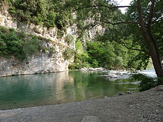
The Roya ( Italian : Roia ) is a river in the border area between France and Italy . It rises in the French Maritime Alps , east of the Col de Tende (Italian: Colle di Tenda), in the municipality of Tende and generally drains in a southerly direction. The upper course of the river is in the French Mercantour National Park . The water has a considerable gradient and is therefore mainly used in the upper reaches of hydropower plants. The middle course at Breil-sur-Roya , on the other hand, has an even flow of water and can therefore be used for kayaking and rafting . The mountain valley of the Roya very often narrows to narrow gorges , but is nevertheless traversed along its entire length by the Tendabahn , one of the most extraordinary transalpine railway lines. The Roya reaches Italian territory at Fanghetto and after a total of 59 kilometers flows into the Mediterranean Sea at Ventimiglia . On its way the river crosses the French department Alpes-Maritimes and the Italian province Imperia .
The Roya below the disused Piène station
After the closure of the Balkan route , the refugees are increasingly trying to get to France through the Royatal. They are supported by committed residents for humanitarian reasons. Law enforcement officers pursue these activities as smuggling .
Places on the river
See also
- List of French Mediterranean tributaries and their tributaries, from 36 km in length, sorted geographically
Web links
Individual evidence
- ↑ geoportail.fr (1: 16,000)
- ↑ geoportail.fr (1: 64,000)
- ↑ a b The information on the length of the river on French territory is based on information on the Roya from SANDRE (French), accessed on October 17, 2010. The total length was taken from the Italian Wikipedia .


