Hearthstone
| Hearthstone | |||
|---|---|---|---|
|
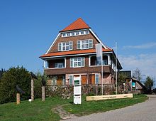
Hearthstone from the ski jump seen |
|||
| Compass direction | west | east | |
| Pass height | 912 m above sea level NN | ||
| state | Baden-Württemberg | ||
| Watershed | Acher → Rhine | Murg → Rhine | |
| Valley locations | Seebach | Baiersbronn- Upper Valley | |
| expansion | L 87, B 500 | L 401 | |
| Mountains | Black Forest | ||
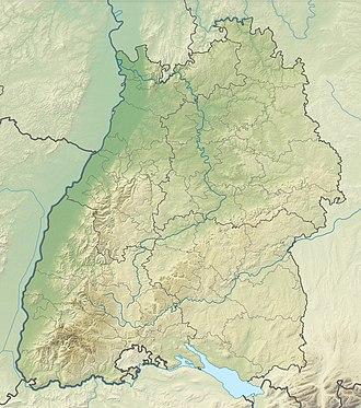
| Map (Baden-Württemberg) | |||
|
|
|||
| Coordinates | 48 ° 33 '40 " N , 8 ° 13' 17" E | ||
The Ruhestein is a pass summit ( 912 m above sea level ) between the Murgtal and the Achertal in the northern Black Forest . It is named after a sandstone boulder of around 2 m³ on a small hill close to the pass, which was used as a resting stone for the haulers and travelers after the ascent . Between 1815 and 1818 the mule tracks were replaced by a steep logging path between the two valleys. Today the cross at Hearthstone Schwarzwaldhochstraße that the main ridge of the Black Forest following Baden-Baden with Freudenstadt connects, and the pass road, consisting of the L 87 from the Achertal in the west and the L 401 from the valley of the Rotmurg.
The border between the Grand Duchy of Baden and the Kingdom of Württemberg and, before that, the Duchy of Strasbourg ran across the top of the pass , as indicated by the boundary signs on the sandstone block. Today this is the government district, rural district and municipal border between Baiersbronn ( Freudenstadt district ) and Seebach ( Ortenaukreis ).
The Ruhestein is a popular excursion and recreational destination as well as a well-known winter sports resort with ski lifts on the Ruhesteinberg, ski jumps ( Große Ruhesteinschanze ) and cross-country trails. The winding road connecting Baiersbronn-Obertal and the Ruhestein was used once on July 21, 1946 for a hill climb event, the Obertal-Ruhestein hill climb , in which three participants were killed.
West of the Ruhestein, the only via ferrata in the northern Black Forest leads over the Karlsruhe ridge .
Around Ruhestein lies one of the two sub-areas of the Black Forest National Park, which has existed since January 1, 2014 . The Ruhestein National Park Center at the top of the pass offers exhibitions and events on nature conservation. The administration of the national park is also located here. The so-called Lothar path on the Schliffkopf was created on a storm-thrown area of the storm Lothar that swept over the area on December 26, 1999 . Along an 800-meter-long teaching and adventure path that leads on footbridges, ladders and bridges through the 10 hectare storm thrown area, it is possible to observe how natural forces work and how natural processes take place on such an area without human intervention.
literature
- Frank Eberle, Hubert Huber, Roger Orlik, Martin Walter: Ruhestein hill climb 1946. The new beginning of German motorsport. SP-Verlag, Albstadt 2011, ISBN 978-3-9812106-0-6 .
Web links
Individual evidence
- ↑ Dieter Ortlam: The origin of the Acher (Northern Black Forest) based on historical research, the glacial genesis of the Ruhestein and the new FRT horizon in the deep red sandstone (Black Forest Hochstrasse) , 2010, accessed on January 16, 2020
- ^ National Park Black Forest Magazine: Why is it actually called Ruhestein and Unterstmatt? , accessed on January 17, 2020
- ↑ Ruhestein hill climb 1946


