Sao Vicente (Sao Paulo)
| Sao Vicente | |
|---|---|
|
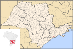
São Vicente in the Brazilian state of São Paulo
|
|
| Basic data | |
| Country | Brazil |
| State | São Paulo |
| Metropolitan area | Baixada Santista |
| City foundation | 1532 |
| Residents | 332,445 (IBGE / 2010) |
| City insignia | |
| Detailed data | |
| surface | 148.1 |
| Population density | 2247.88 inhabitants / km 2 |
| Post Code | 11300-11390 |
| São Paulo (center) and Baixada Santista on the coast | |
São Vicente is a city in the Brazilian state of São Paulo, about 50 km southeast of the city of São Paulo . The place is located both on the mainland and in the west of the island of the same name, whose eastern part is in turn part of the port city of Santos . 365,798 inhabitants live in an area of 148 km² (2019 estimate). Since 1914 the island and mainland have been connected by a bridge. São Vicente is part of the Baixada Santista metropolitan area .
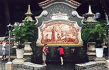
São Vicente became the first permanent Portuguese settlement in America in 1532 and was important in supplying the colony with slaves. Today, however, very few historical monuments remind of this past.
The city is officially a spa ( Estância Balneária ). The economy of the place with its five beaches is determined by tourism, although fishing is also practiced to a lesser extent. For many workers employed in Santos, São Vicente serves as a dormitory city.
sons and daughters of the town
- Elisabeth Nobiling (1902–1975), sculptor
- Wlamir Marques (born 1937), basketball player
- Jefferson de Oliveira Galvão (* 1983), football goalkeeper
- Robinho (* 1984), football player
- Marcelo Antônio Guedes Filho (* 1987), football player
- Vinicius José Ignácio (* 1991), football player
- Caio César da Silva Silveira (* 1995), football player
Web links
Individual evidence
- ↑ a b IBGE : Cidades @ São Paulo: São Vicente. Retrieved August 29, 2019 (Brazilian Portuguese).
|
||||


