Guarujá
| Município da Estância Balneária do Guarujá "Pérola do Atlântico"
Guarujá
|
|||
|---|---|---|---|
|
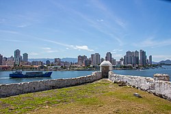
View of Guarujá from Fortaleza de Santo Amaro da Barra Grande
|
|||
|
|
|||
| Coordinates | 24 ° 0 ′ S , 46 ° 15 ′ W | ||
 Location of Guarujá in the state of São Paulo Location of Guarujá in the state of São Paulo
|
|||
| Symbols | |||
|
|||
|
Motto “Pro Mare Nostrum” for our sea |
|||
| founding | September 2, 1893 | ||
| Basic data | |||
| Country | Brazil | ||
| State | São Paulo | ||
| ISO 3166-2 | BR-SP | ||
| Região intermediária | São Paulo (since 2017) | ||
| Região imediata | Santos (since 2017) | ||
| Metropolitan area | Baixada Santista | ||
| height | 10 m | ||
| Waters | Atlantic Ocean | ||
| climate | Cfa, subtropical maritime climate | ||
| surface | 142.6 km² | ||
| Residents | 290,752 (2010) | ||
| density | 2,039.1 Ew. / km² | ||
| estimate | 318,107 (July 1, 2018) | ||
| Parish code | IBGE : 3518701 | ||
| Time zone | UTC −3 | ||
| Website | www.guaruja.sp.gov.br (Brazilian Portuguese) | ||
| politics | |||
| City Prefect | Valter Suman (2017-2020) | ||
| Political party | Partido Socialista Brasileiro (PSB) | ||
| economy | |||
| GDP | 8,197,088 thousand. R $ 26,338 R $ per capita (2015) |
||
| HDI | 0.751 (2010) | ||
|
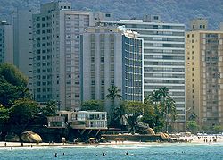
Beach Praia das Astúrias in Guarujá
|
|||
Guarujá , officially Portuguese Município da Estância Balneária do Guarujá , is a city on the coast of the Brazilian state of São Paulo . The city is located on the Ilha de Santo Amaro (island of Santo Amaro, third largest island off the coast of São Paulo) and is part of the metropolitan area of Baixada Santista around the port city of Santos, less than 10 km to the west . The distance to the state capital São Paulo is around 95 km. According to an estimate as of July 1, 2018, Guarujá has 318,107 inhabitants on an area of around 143 km² - which results in a population density for 2018 of 2231 people per square kilometer.
General
The community, which likes to call itself the pearl of the Atlantic , has the official status of a spa, an Estância balneária . The economy is determined by tourism. Numerous beaches attract visitors, especially from the state capital São Paulo with its more than 10 million people. In the 1970s, the then much smaller town was still very chic. Today's overdevelopment is easy to see from the beaches lined with high-rise buildings.
Beaches such as Praia da Pitangueiras and Praia das Astúrias are popular; The Praia do Tombo is particularly recommended for surfers.
| Municipalities of the metropolitan area of Baixada Santista | |
|---|---|
history
The place was initially known as Vila Balneária de Guarujá , on June 30, 1934 the Vila received the official title of a seaside resort ( Estância Balneária ) and in 1947 became an independent Município .
City administration and structure
Executive: In the local elections in 2016, Valter Suman became city prefect (mayor) for the term from 2017 to 2020, who ran for the Partido Socialista Brasileiro (PSB).
The legislature consists of the city council (Câmara Municipal) with 17 elected city councilors (vereadores). Edilson Dias de Andrade is President for the 2017 to 2018 term.
The urban area of Guarujá has been divided into two districts since 1964, the Distrito Sede de Guarujá and the Distrito de Vicente de Carvalho . These are divided into four regions with a total of 38 districts ( Bairros ):
- District of Guarujá, Region 1: Pitangueiras, Astúrias, Tombo, Guaiúba, Santa Cruz dos Navegantes, Barra Grande, Marinas, Vila Ligia, Santa Maria, Santa Rosa, Las Palmas, Helena Maria, Santo Antonio and Cachoeira;
- District of Guarujá, Region 3: Itapema, Bocaina, Parque Estuário, Paecará, Jardim Progresso, Vila Áurea, Boa Esperança, Conceiçãozinha and Porto de Guarujá;
- Vicente de Carvalho district, region 2: Enseada, Cidade Atlântica, Virgínia, Pedreira, Península, Mar e Céu, Pernambuco, Acapulco, Santo Amaro, Perequê and Guararú;
- Vicente de Carvalho district, region 4: Morrinhos, Vila Zilda, Retroporto, Vargem Grande and Saco do Funil.
Population development
Source: IBGE / SIDRA (data for 2018 are only estimates).

Web links
- City Prefecture website , Prefeitura Municipal (Brazilian Portuguese)
- City Council website , Câmara Municipal (Brazilian Portuguese)
- IBGE : Guarujá - Panorama , updated statistics (Brazilian Portuguese)
Individual evidence
- ↑ a b Dr Valter Suman 40. In: com.br. Eleições 2016, accessed April 7, 2018 (Brazilian Portuguese).
- ^ Atlas do desenvolvimento humano no Brasil - Guarujá, SP . Retrieved April 7, 2018 (Brazilian Portuguese).
- ↑ a b Instituto Brasileiro de Geografia e Estatística (IBGE): Estimativas da população residente no Brasil e unidades da federação com data de referência em 1 ° de julho de 2018. (PDF; 2.6 MB) In: ibge.gov.br . 2018, accessed October 1, 2018 (Brazilian Portuguese).
- ↑ Lonely Planet, August 3, 2008: Introducing Guarujá ( Memento of the original from November 17, 2009 in the Internet Archive ) Info: The archive link was inserted automatically and has not yet been checked. Please check the original and archive link according to the instructions and then remove this notice.
- ↑ História e Cultura. In: gov.br. Retrieved April 7, 2018 (Brazilian Portuguese).
- ↑ Câmara Municipal de Guarujá - Vereadores. In: gov.br. Retrieved April 7, 2018 .
- ↑ Leis Municipais. In: com.br. leismunicipais.com.br, accessed April 8, 2018 (Brazilian Portuguese, Articles 65 and 66 of the City Council).
- ↑ IBGE : Tabela 200: População residente, por sexo, situação e grupos de idade. Sistema IBGE de Recuperação Automática - SIDRA, accessed on April 8, 2018 (Brazilian Portuguese, database query: search terms Guarujá and População).


