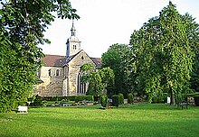
The municipality of Grasleben
| coat of arms | Germany map | |
|---|---|---|

|
Coordinates: 52 ° 19 ' N , 11 ° 1' E |
|
| Basic data | ||
| Existing period: | 1974– | |
| State : | Lower Saxony | |
| County : | Helmstedt | |
| Area : | 45.21 km 2 | |
| Residents: | 4444 (Dec. 31, 2019) | |
| Population density : | 98 inhabitants per km 2 | |
| License plate : | HE | |
| Association key : | 03 1 54 5401 | |
| Association structure: | 4 municipalities | |
| Association administration address : |
Bahnhofstrasse 4 38368 Grasleben |
|
| Website : | ||
| Mayor of the municipality : |
Gero Janze (independent) | |
| Location of the integrated community of Grasleben in the Helmstedt district | ||
The integrated community of Grasleben is an administrative community with around 5000 inhabitants in the Helmstedt district , Lower Saxony ( Germany ).
geography
The landscape of the municipality is located on the Lappwald . The district town of Helmstedt , which is only about 9 km from the administrative seat Grasleben, borders south of the integrated community. Furthermore, the joint municipality borders in the south on the joint municipality Nord-Elm , in the west on the city of Königslutter am Elm and in the north on the joint municipality Velpke . In the east the town borders Oebisfelde-Weferlingen the district Börde on. The eastern joint municipality border is also the state border with Saxony-Anhalt . Until German reunification in 1990, this was also the so-called inner German border .
Joint community structure
The municipalities of Mariental , Querenhorst and Rennau as well as Grasleben , where it has its administrative headquarters, belong to the combined municipality .
The uninhabited community-free area of Mariental , which is 15.81 km² in size, divides the combined community into two non-contiguous parts: Rennau and Mariental in the southwest and the other two member communities in the northeast.
history
The joint municipality was formed in 1974 as part of the regional reform .
politics
The Samtgemeinderat is composed of 14 councilors and councilors
- CDU 8 seats
- FDP 1 seat
- Citizens' list of the municipality of Grasleben 4 seats
- Lappwald parliamentary group, municipality of Grasleben, 1 seat
(Status: local election September 11, 2016)
as well as the full-time mayor of the municipality
- Gero Janze (independent)
(Status: Election July 8, 2012)
literature
- Joachim Schmid: Grass life - from a farming village to an industrial community . Grasleben 2000, ISBN 3-00-007248-9 .
Web links
Individual evidence
- ↑ State Office for Statistics Lower Saxony, LSN-Online regional database, Table 12411: Update of the population, as of December 31, 2019 ( help ).
- ↑ Compilation of the results of the election of the mayor of the municipality on July 8th, 2012. (PDF; 39 kB) of the municipality of Grasleben, July 9th, 2012, accessed on August 19th, 2012 .


