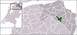
Hoogezand-Sappemeer
 flag |
 coat of arms |
| province |
|
| local community |
|
|
Area - land - water |
72.99 km 2 66.46 km 2 6.53 km 2 |
| Residents | 34,161 (Dec. 31, 2017) |
| Coordinates | 53 ° 10 ′ N , 6 ° 46 ′ E |
| Important traffic route |
|
| prefix | 0598 |
| Postcodes | 9601-9609, 9611-9614 |
Hoogezand-Sappemeer ( ) is a former municipality in the province of Groningen in the Netherlands . Until the dissolution of the municipality, 34,161 inhabitants lived in Hoogezand-Sappemeer (as of December 31, 2017) on 72.99 km², most of them in the twin village of Hoogezand-Sappemeer, where the local administration is also located. Other villages in the former municipality are Kropswolde and Kiel-Windeweer.
After the merger with the former municipalities of Menterwolde and Slochteren , it has formed the new municipality of Midden-Groningen since January 1, 2018 .
history
In the Middle Ages, the municipality belonged to Gorecht and was under the jurisdiction of the city of Groningen . At that time only the current districts of Westerbroek and Kropswolde existed as small parishes . The rest of the area was mostly moorland. In the 17th century, bog colonization began and the villages of Hoogezand and Sappemeer were founded . In 1949 both communities merged. In the regional development plan Groningen-Assen 2030 , numerous housing construction measures are planned in the municipality . Hoogezand-Sappemeer is expected to grow to 45,000 inhabitants by 2030.
traffic
The highway section 7 ( European route E22 ) ( Amsterdam - Groningen - Germany ) runs through the community. There is also a railway line with connections to Groningen, Nieuweschans and Leer ( Leer – Groningen line ). There are four train stations on this route in the municipality, namely Kropswolde, Martenshoek, Hoogezand-Sappemeer and Sappemeer Oost. Every train stops in Martenshoek and Hoogezand-Sappemeer, but only once an hour at the other stations.
politics
Distribution of seats in the municipal council
The municipal council had 23 seats. The Socialist Party was the largest, but in addition to the Social Democratic PvdA and the Green Groenlinks , the Liberal VVD and the Christian Democratic CDA also took their places on the parish council .
| Political party | Seats | |||
|---|---|---|---|---|
| 2002 | 2006 | 2010 | 2014 | |
| SP | - | - | - | 5 |
| PvdA | 6th | 11 | 8th | 3 |
| VVD | 4th | 2 | 3 | 3 |
| HS Centraal! | - | - | - | 3 |
| Roodgewoon | 1 | 1 | 2 | 2 |
| D66 | 0 | - | 2 | 3 |
| ChristenUnie | 1 | 1 | 2 | 1 |
| GroenLinks | 3 | 3 | 2 | 2 |
| CDA | 2 | 2 | 2 | 1 |
| Local Centraal | 4th | 2 | 2 | - |
| Progressive Hoogezand-Sappemeer | 2 | 1 | - | - |
| total | 23 | 23 | 23 | 23 |
mayor
Most recently, Peter de Jonge ( PvdA ) was mayor of the municipality.
Attractions
- Lake Zuidlaardermeer (campsites, marina, holiday apartments, bird sanctuaries on the banks)
photos
Born in Hoogezand-Sappemeer
- Aletta Jacobs (February 9, 1854 to August 10, 1929), feminist
- Geerat Vermeij (* 1946 in Sappemeer), paleontologist and zoologist
- Koert Thalén (born February 16, 1987), football player
- Marianne Timmer (born October 3, 1974), speed skater, three-time Olympic champion
Web links
Individual evidence
- ↑ a b Bevolkingsontwikkeling; regio per maand Centraal Bureau voor de Statistiek , accessed on June 28, 2018 (Dutch)
- ↑ Allocation of seats in the municipal council: 2002 2006 2010 2014 , accessed on June 28, 2018 (Dutch)


