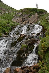
Schmalzgrube (Muhrtal)
| Lard pit | ||
|---|---|---|
| location | Salzburg , Austria | |
| Waters | Mur | |
| Mountains | Hafner Group , Hohe Tauern | |
| Geographical location | 47 ° 7 '38 " N , 13 ° 20' 48" E | |
|
|
||
| height | 2000 m above sea level A. | |
| length | 1.5 km | |
The Schmalzgrube is the very deepest valley of the Mur . It is located near Muhr im Lungau , in the province of Salzburg .
Location and landscape

The uppermost valley of the Mur is called Muhrtal or - especially the rear section - Murwinkel . At the Stickleralm, this north-west trending valley bends to south-west, and then ends after a good 5 kilometers. The cirque in the last section is the lard pit.
It lies between the Murtörl ridge ( 2402 m above sea level ) - Mureck - Schöderhorn (Großes Mureck, 2475 m above sea level ) - Schöderscharte to the west, and the ridge of the Rosskar Frischinghöhe ( 2466 m above sea level ) - Rosskarscharte - Frauennock ( 2678 m above sea level ) - Schmalzscharte east. The two ridges meet in the Marchkareck ( 2661 m above sea level ), which forms the head of the Schmalzgrube valley . These mountains belong to the Hafner group of the Ankogel group . North of the Murtörl line, the Mur separates the Hohe Tauern from the Niederen Tauern , here the Radstädter Tauern .
The rear area of the Schmalzgrube is rubble from glaciers that have long since disappeared. There is a source of rubble at approx. 2050 m above sea level. A. the top source of the Mur. In the outer lard pit is then at 1998 m above sea level. A. the powerful source of the Mur , which rises as a layer spring from a limestone bank.
The Talung belongs to the Hohe Tauern National Park as well as to the Lungau – Nockberge Biosphere Park .
Tours
The path runs through the Schmalzgrube from the Sticklerhütte over the Schmalzscharte ( 2661 m above sea level ) - Schwarzseen - Weinschnabel - Kölnbreinspeichersee to the Osnabrücker Hütte (variant of the Central Alpine Trail , Austrian long-distance hiking trail 02) as a transition into the Carinthian Malta Valley . The Albertbiwak , a bivouac box, is located on the Schmalzscharte .
Shortly before the Schmalzgrube, the path branches off to Murtörl , the transition to Hüttschlag in the Pongauer Großarltal . On the Murtörl, the high trail of the ÖWW 02 runs from the Tappenkarseehütte (in the Kleinarltal), which passes in the upper slopes of the Schmalzgrube Mureck and Schöderhorn.
Individual evidence
-
↑ The traces of the Little Ice Age from the 15th to the 19th century lie here in the area up to 2400 m .
Compare Christian Steinwender, Lukas Plan: Kontaktkarst in the Murursprung-Rosskar area (Lungau, Salzburg). In: Die Höhle 62 (2011), Section Glacial Traces , p. 26, full article, p. 15–26, PDF on ZOBODAT there p. 11.
A travel guide from 1845 describes the upper Muritzen , where there are only isolated remains today, as “Surrounded by eternal ice”: (FC Weidmann, ed. :) Tourist guide on excursions and hikes in Salzburg. Volume 1 (first main part, general overview. City of Salzburg, surroundings of the city, Pongau and Lungau. ), Verlag Carl Gerold, Vienna 1845, section Die Thauerntäler des Pongau's and Lungau’s , 7. Murwinkel and Murthal (Lungau) , p. 291 (section Pp. 290-303, Google eBook, full view ). - ↑ Stage 21A in Hans Führer: Tauern-Höhenweg: From the Seckauer Tauern to the Ahrntal in South Tyrol. Series Rother Wanderführer Special , Bergverlag Rother, 2016 ISBN 9783763342631 , p.168 f.
