Perlenbach (Rur)
|
Perlenbach Schwalmbach (upper course in B ) , Perlbach |
||
|
Perlenbach |
||
| Data | ||
| Water code | DE : 28214 | |
| location |
Eifel
|
|
| River system | Rhine | |
| Drain over | Rur → Maas → Hollands Diep → North Sea | |
| River basin district | Meuse | |
| source | north of Rocherath-Krinkelt ( Belgium ) 50 ° 28 ′ 14 ″ N , 6 ° 17 ′ 36 ″ E |
|
| Source height | approx. 600 m OR | |
| muzzle | near Monschau in the Rur coordinates: 50 ° 32 ′ 56 ″ N , 6 ° 13 ′ 51 ″ E 50 ° 32 ′ 56 ″ N , 6 ° 13 ′ 51 ″ E |
|
| Mouth height | approx. 420 m above sea level NHN | |
| Height difference | approx. 180 m | |
| Bottom slope | approx. 10 ‰ | |
| length | 17.6 km | |
| Catchment area | 62.638 km² | |
| Drain at the mouth |
MNQ MQ |
78.25 l / s 1.485 m³ / s |
|
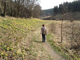
Perlenbachtal in spring |
||
The Perlenbach is an approximately eighteen kilometer long, southern and right tributary of the Rur in the German-Belgian border area near Monschau and Bütgenbach .
geography
course
The Perlenbach rises as a Schwalmbach in the High Fens . The source of the brook, which runs entirely in the Hohes Venn-Eifel Nature Park , is in the municipal area of Bütgenbach , four kilometers north of Rocherath-Krinkelt on the Belgian military training area of Elsenborn at an altitude of around 600 m .
The Schwalmbach flows to the west, changes its direction to the north after about four kilometers. After almost seven kilometers of flowing, it takes the Krockesbach from the right. The name changes, from here the stream is called Perlenbach . After another kilometer, the Jägersief flows from the right. The Perlenbach now marks the border between Belgium and Germany for half a kilometer. In Germany it flows through the nature reserves Perlenbach-Fuhrtsbachtal-Talsystem and Unteres Perlenbachtal with the rock formations of Teufelsley, Engelsley, Bromelsley and Pferdeley . The Perlenbach is dammed west of Höfen between river km 3.8 and 2.3 to the Perlenbachtalsperre .
Finally reaches the Perlenbach Monschau , where he on about 420 m altitude in the coming there from West Maas influx Roer at river km 147.4 empties .
Catchment area and tributaries
The catchment area of the Perlenbach is 62.638 km² and drains into the North Sea via the Rur, Maas and Hollands Diep.
|
Stat. in km |
Surname | GKZ | location | Length in km |
EZG in km² |
|---|---|---|---|---|---|
| 15.3 | Krehbach | 28214-112 | Left | 3,978 | |
| 13.6 | Drosbach | 28214-12 | Left | 3.464 | 5.628 |
| 12.0 | Büllinger Furtsbach | 282142 | Left | 3.738 | 8,836 |
| 10.8 | Krockesbach | 28214-32 | right | 4.159 | |
| 9.6 | Jägersief | 28214-4 | right | 1.652 | 6.297 |
| 8.8 | Heisterbach | 28214-52 | Left | 1.934 | |
| 7.9 | Heisterbach | 28214-54 | Left | 1.103 | |
| 7.4 | Pfaffenborn | 28214-56 | right | 0.882 | |
| 6.1 | Afterbach | 28214-58 | Left | 1.325 | |
| 5.1 | Fuhrtsbach | 28214-6 | right | 6.457 | 13.253 |
| 3.2 | Römerbach | 28214-8 | Left | 1,962 | 3.122 |
| 2.2 | Hasselbornbach | 28214-992 | right | 0.761 |
Notes on the table
- ↑ Water code number , in Germany the official river code number with a separator inserted after the prefix for better readability, which stands for the shared waterway Perlenbach .
Perlenbachtal
For the cultural history and the name of the brook, see
Web links
- "Perlenbach-Fuhrtsbachtal-Talsystem" nature reserve in the specialist information system of the State Office for Nature, Environment and Consumer Protection in North Rhine-Westphalia
- Nature reserve "Unteres Perlenbachtal with the rock formations of the Teufelsley, Engelsley, Bromelsley and Pferdeley" in the specialist information system of the State Office for Nature, Environment and Consumer Protection in North Rhine-Westphalia
Individual evidence
- ↑ a b Topographical Information Management, Cologne District Government, Department GEObasis NRW ( Notes )
- ^ German basic map 1: 5000
- ↑ a b c d Water directory of the State Office for Nature, Environment and Consumer Protection NRW 2010 (XLS; 4.67 MB) ( Notes )
- ↑ ELWAS card
- ↑ Perlenbach waterworks - overview map of the catchment area. ( Memento from March 5, 2016 in the Internet Archive ) In: wasserwerk-perlenbach.de (PDF; 123 kB)

