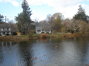
Setauket-East Setauket
| Setauket-East Setauket | ||
|---|---|---|
 |
||
| Location in New York | ||
|
|
||
| Basic data | ||
| State : | United States | |
| State : | new York | |
| County : | Suffolk County | |
| Coordinates : | 40 ° 56 ′ N , 73 ° 6 ′ W | |
| Time zone : | Eastern ( UTC − 5 / −4 ) | |
| Residents : | 15,477 (as of 2010) | |
| Population density : | 700.3 inhabitants per km 2 | |
| Area : | 24.2 km 2 (approx. 9 mi 2 ) of which 22.1 km 2 (approx. 9 mi 2 ) is land |
|
| Height : | 30 m | |
| Postal code : | 11733 | |
| Area code : | +1 631 | |
| FIPS : | 36-66481 | |
| GNIS ID : | 2390276 | |
Setauket-East Setauket is a census-designated place (statistical area) on the north coast of Long Island in the US state of New York . It includes the three unincorporated hamlets , so settlements without self-government, Setauket , East Setauket and Strongs Neck within the town of Brookhaven in Suffolk County . According to the 2010 census, the area had 15,477 residents.
geography
The three hamlets (Engl. Hamlets ) have together covers an area of 24.2, of which 22.1 square kilometers land and 2.1 square kilometers of water surface. Strongs Neck is a peninsula between Conscience Bay and Port Jefferson Harbor , the southwesternmost branch of which is called Setauket Harbor . These are bays of Long Island Sound . The other two places are south of it inland.
Adjacent places are west of Stony Brook and Old Field , south of Centereach , southeast of Terryville , east of Port Jefferson Station and northeast of Port Jefferson and Poquott .
In the south of the area there are also industrial and commercial facilities, otherwise it is characterized by residential and forest areas.
history
On April 14, 1655 bought Europeans the area to Setalcott - Indians from, one of which also dates the later place name, the settlement initially under the name Ashford began. Brookhaven was founded on March 7, 1666, the most important settlement of which was Setauket and the seat of government until 1789.
In the War of Independence Setauket garrison was the British troops. American troops under Abraham Parsons landed on August 22, 1777, but were unable to occupy the place. Another attack took place in November 1780 under Benjamin Tallmadge . From 1778 Setauket was the base of an espionage network against the British. George Washington therefore visited the place on April 22, 1790 .
Setauket was an important shipbuilding site in the 19th century and a tourist destination at times in the early 20th century. Between 1879 and 1937 there was a bridge over the bay at Strong's Neck.
Culture and sights
Setauket has some preserved colonial-era buildings, including the Caroline Church from 1729 and the Setauket Presbyterian Church from 1660. The Emma S. Clark Library is a large public library. Setauket is the seat of the Orthodox Patriarchate of Jerusalem for the American continent.
Infrastructure
Setauket is connected to the Long Island Expressway ( Interstate 495 ). The LIRR route between Port Jefferson and Penn Station runs through the area but has no stop here.
media
The TV series Turn: Washington's Spies, produced by the AMC , is set in Setauket .
sons and daughters of the town
- Caleb Brewster (1747–1827), spy in the American Revolutionary War and member of the Culper Ring
- Abraham Woodhull (1750–1826), spy in the American Revolutionary War and member of the Culper Ring
- William Sidney Mount (1807–1868), painter
- Erik Burgdoerfer (* 1988), ice hockey player
Web links
- Newsday.com for local history
- History of Setauket (Three Villages School District)


