Seward Peninsula
| Seward Peninsula | ||
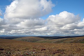
 Tundra in the Bering Land Bridge National Preserve |
||
| Geographical location | ||
|
|
||
| Coordinates | 65 ° 30 ′ N , 163 ° 30 ′ W | |
| Waters 1 | Chukchi Sea ( Arctic Ocean ) | |
| Waters 2 | Bering Sea , Bering Strait | |
| length | 320 km | |
| width | 225 km | |
The Seward Peninsula ( English Seward Peninsula ) is an approximately 320 kilometers long and 145 to 225 kilometers wide peninsula on the west coast of Alaska between Kotzebue Sound in the north and Norton Sound in the south. It was named after William H. Seward , the politician who negotiated the purchase of Alaska from Russia .
geography
The peninsula separates the Chukchi Sea in the north and the Bering Sea in the south. The western tip of the peninsula, the Cape Prince of Wales , lies on the Bering Strait and is only 83 kilometers as the crow flies from the Asian mainland. It is the closest point in mainland America to Asia.
The north-western coast of the peninsula is characterized by long, partly interrupted spits that extend from Cape Prince of Wales to Cape Espenberg , the northern tip of the peninsula. Inland there are several mountain ranges of volcanic origin. The world's largest maars are in the Devil Mountains in the north . They were created around 21,000 years ago by underground steam explosions. In the south, from west to east, lie the York Mountains , Kigluaik Mountains , Bendeleben Mountains and Darby Mountains . The highest point on the peninsula is Mount Osborn, 1437 meters high in the Kigluaik Mountains.
North of Kuzitrin Lake is an approximately 1000 to 2000 year old cooled lava flow , the Lost Jim Lava Flow , which covers an area of 228 km². Volcanic activity can still be seen on the peninsula today, mainly in the form of hot springs .
The longest rivers on the peninsula are the Koyuk River and the Kuzitrin River . Both rivers have their source near Kuzitrin Lake, the Koyuk River drains southeast into Norton Bay , and the Kuzitrin River flows west into the Imuruk Basin . Other important rivers are the Nome River and the Niukluk River in the south of the peninsula.
In the north of the peninsula is the Bering Land Bridge National Preserve .
population
The Seward Peninsula is very sparsely populated, the largest settlements are Nome with around 3800 inhabitants and Shishmaref with around 600 inhabitants . The native inhabitants of the peninsula are the Inupiat , who number around 7500 people .
history
During the last great Ice Age, what is now Seward Peninsula was part of Beringia , a land bridge between Siberia and Alaska that brought the ancestors of the Native Americans to America. In 1898 gold was found on the Seward Peninsula, near the town of Nome, which triggered a brief economic boom. Three railways, the Seward Peninsular Railroad in Nome, the Golovin Bay Railway in the now defunct Council gold rush settlement, and the Council City and Solomon River Railroad in Dickson were built, but closed again after a few years as the gold deposits were largely exhausted. The only paved roads on the peninsula were also developed by Nome during the gold years.
literature
- Brina Kessel: Birds of the Seward Peninsula, Alaska: Their Biogeography, Seasonality and Natural History , University of Alaska Press. ISBN 0912006293 .
- Alaska Geographic Quarterly, Volume 14, Number 3: Alaska's Seward Peninsula. 109 pages. ISBN 0-88240-182-3
Web links
- Alaska Volcano Observatory (information about volcanic activity on the Seward Peninsula)
Individual evidence
- ↑ Volcanoes, permafrost, earthquakes shape Alaska ( Memento of the original from September 26, 2008 in the Internet Archive ) Info: The archive link was inserted automatically and has not yet been checked. Please check the original and archive link according to the instructions and then remove this notice. Alaska Science Forum. (English)
