
Shuili
|
Shuili 水里 鄉 |
|||
.svg) Location Shuilis in Nantou County |
|||
| State : |
|
||
| County : | Nantou | ||
| Coordinates : | 23 ° 48 ' N , 120 ° 51' E | ||
| Area : | 106.8424 km² | ||
| Residents : | 17,496 (Dec 2018) | ||
| Population density : | 164 inhabitants per km² | ||
| Time zone : | UTC + 8 (Chungyuan time) | ||
| Telephone code : | (+886) (0) 49 | ||
| Postal code : | 553 | ||
| ISO 3166-2 : | TW-NAN | ||
| Community type : | Rural community ( 鄉 , Xiāng ) | ||
| Structure : | 19 villages ( 村 , Cūn ) | ||
| Mayor : | Chen Yuyou ( 陳 癸 佑 ) | ||
| Website : | |||
|
|||

Shuili ( Chinese 水里 鄉 , Pinyin Shuǐlǐ Xiāng , Tongyong Pinyin Shuěilǐ Siang ) is a rural community ( 鄉 , Xiāng ) in Nantou County in central Taiwan .
Location description
Shuili is roughly in the center of Nantou County on the western edge of the Central Mountains . The topography is strongly characterized by river valleys and rivers (the name Shuili literally means "in the water"). The river Chenyoulan ( 陳有蘭 溪 ) runs from the south and flows in the middle of Shuili into the Zhuoshui, which flows in an east-west direction . Downstream of this, the small river Shuili Xi ( 水里 溪 ), coming from the north, flows into the Zhuoshui, which is dammed about 2.5 kilometers before the mouth through the Mingtan Dam to the Mingtan Reservoir. The reservoir serves as a storage basin which, depending on the energy requirement, is partially drained or filled by a pumped storage plant . When there is a surplus of electricity, water is pumped from the reservoir into the higher-lying Sun-Moon Lake in the neighboring municipality of Yuchi. At the same time, the reservoir also serves to regulate the flow of water to the Zhuoshui.
The neighboring communities of Shuilis are Yuchi in the northeast, Xinyi in the east and south, Lugu in the southwest, Jiji and Mingjian in the west and northwest, and Guoxing in a small section in the north.
history
The indigenous people of Shuili were Austronesian tribes, the ancestors of today's indigenous peoples of Taiwan . The first Han Chinese settled in the first years of the reign of the Qing Emperor Guangxu and began the systematic agricultural cultivation of the largely forested land. At the time of the Japanese colonial rule (1895-1945), camphor production and forestry were of great importance. The number of Han Chinese increased by immigration and the indigenous population was largely pushed further south and east. After Taiwan was handed over to the Republic of China in 1945, Shuili was initially administratively part of the Jiji municipality, but became part of the newly founded Nantou County in 1950 as the Shuili rural municipality ( 水裡 鄉 , from 1966 in the spelling 水里 鄉 ). In 1955, the two villages of Yongxing and Yufeng were separated from the neighboring community of Lugu and incorporated into Shuili. The importance of forestry has declined significantly over the last few decades and, like many other rural areas in Taiwan, Shuili is characterized by rural exodus and increasing aging. Current efforts are aimed at developing the place into a tourist center.
traffic
Shuili has two Jiji Line stations : Shuili Station and Checheng Terminal Station. Both started operating on January 14, 1922. The road connections are mostly based on the river valleys. Provincial road 16 runs along the Zhuoshui river valley in east-west direction. Provincial road 21 runs south, largely in the Chenyoulan river valley , and joins provincial road 16 in the center of Shuili for a short distance and then branches off again and heads north moves towards Sun-Moon-Sea. County road 121 runs along the Shuili Xi river valley .
Residents
The population of Shuili has been falling for decades. In 1981 the community still had 29,334 inhabitants, compared to only 17,496 at the end of 2018. At the end of 2017, 425 people (2.4%) belonged to the indigenous peoples. Among them is one of the two main Thao settlements in the village of Dingkan (settlement 大 平林 , Dàpínglín , the other is about 14 km away on the southeastern shore of the Sun and Moon Lake).
Administrative division
| Outline of Shuili |
|
|

Shuili is divided into 19 villages ( 村 , Cūn ):
1. Xinxing (新興 村)
2. Checheng (車 埕 村)
3. Shuili (水里 村)
4. Xincheng (新城 村)
5. Nongfu (農 富 村)
6. Chengzhong (城中村)
7. Zhongyang (中央 村)
8. Beipu (北埔 村)
9. Nanguang (南 光 村)
10. Yufeng (玉峰 村)
11. Yongfeng (永豐 村)
12. Jugong (鉅 工 村)
13. Dingkan (頂 崁 村)
14. Minhe (民和 村)
15. Yongxing (永興 村)
16. Xinglong (興隆 村)
17. Xinshan (新 山村)
18. Junkeng (郡 坑村)
19. Shang'an (上 安 村)
Sightseeing and tourism
The main attraction is nature with its mixture of river and mountain landscape. Along the riverside there is a riverside cycle path (水岸 自行車 道) that can be used to ride to the Sun Moon Lake. The wood -burning snake kiln built in 1927 is well worth seeing ( 水里 蛇 窯 , ). The stove got its name from its elongated snake neck shape. Pottery used to be fired here. Today there is a small ceramic museum with the ceramic culture park Shuili ( 陶藝 文化 園區 ). There is a Trappist monastery ( ) in the village of Shuili .
![]()
![]()

Zhuoshui River Plain in Shuili

Shuili Xi river bed
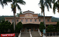
Shuili Railway Station


Web links
Individual evidence
- ↑ 地理位置 ("Geographical Location"). Shuili's website, accessed January 9, 2019 (Chinese).
- ↑ 歷史 足跡 ("Traces of History"). Shuili's website, accessed February 9, 2019 (Chinese).
- ↑ Shueli Station. travel.nantou.gov.tw, accessed February 9, 2019 .
- ↑ Checheng. travel.nantou.gov.tw, accessed February 9, 2019 .
- ↑ 水里 鄉 觀光 導覽 地圖 -Part1 (“Tourist sightseeing guide for Shuili part 1”). Shuili's website, accessed January 9, 2019 (Chinese).
- ↑ 內政部 統計 月報 (“Monthly Statistics of the Ministry of the Interior”), Tables 1.10- 歷年 各 鄉鎮 市區 人口 數 (“1.10 population by municipalities and districts since 1981”). Taiwan Ministry of the Interior, accessed February 9, 2019 (English, Chinese).
- ↑ 原住民 戶數 及 人數 Households and Persons of Indigenous People. (xls) Taiwan Ministry of the Interior, accessed May 19, 2018 (Chinese / English).
- ↑ Thao. Ethnologue, accessed on February 9, 2019 .
- ↑ 水岸 自行車 道 ("Riverside Bicycle Path"). Shuili's website, accessed February 9, 2019 (Chinese).
- ↑ Shuili Snakekiln Ceramics Cultural Park. Retrieved February 9, 2019 (English, Chinese).
- ↑ Shueli Snake Kiln. travel.nantou.gov.tw, accessed February 9, 2019 (Chinese).
- ↑ Monastery of the Holy Mother of God. Website of the monastery, accessed on February 9, 2019 (English, Chinese).