
Siem Reap (Province)
| សៀមរាប Siem Reap Province
|
|
|---|---|
  |
|
| Basic data | |
| Country | Cambodia |
| Capital | Siem Reap |
| surface | 10,299 km² |
| Residents | 1,144,000 (2017) |
| density | 111 inhabitants per km² |
| ISO 3166-2 | KH-17 |
 |
|
Coordinates: 13 ° 21 ' N , 103 ° 51' E
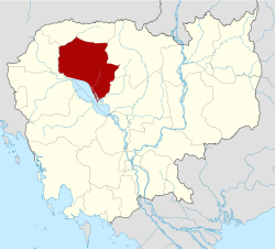
Siem Reap ( Khmer សៀមរាប , IPA : [ siəm riəp ]) is a Cambodian province . The provincial capital is also called Siem Reap .
The province is divided into 12 districts, 100 municipalities and 907 villages:
| Geocode | Khmer | District names |
|---|---|---|
| 1701 | ស្រុក អង្គរជុំ | Angkor Chum |
| 1702 | ស្រុក អង្គរធំ | Angkor Thum |
| 1703 | ស្រុក បន្ទាយស្រី | Banteay Srei |
| 1704 | ស្រុក ជីក្រែង | Chi Kraeng |
| 1705 | ស្រុក ក្រឡាញ់ | Kralanh |
| 1706 | ស្រុក ពួក | Puok |
| 1707 | ស្រុក ប្រាសាទបាគង | Prasat Bakong |
| 1708 | ក្រុង សៀមរាប | Siem Reab |
| 1709 | ស្រុក សូត្រ និគម | Soutr Nikom |
| 1710 | ស្រុក ស្រីស្នំ | Srei Snam |
| 1711 | ស្រុក ស្វាយ លើ | Svay Leu |
| 1712 | ស្រុក វ៉ារិន | Varin |
Population development
| year | Population numbers |
|---|---|
| 1998 | 696.164 |
| 2008 | 896.443 |
| 2013 | 922.982 |
| 2017 | 1,144,000 |
Web links
Commons : Siem Reap Province - Collection of pictures, videos and audio files
Wikivoyage: Siem Reap Province - Travel Guide
Individual evidence
- ↑ Statistically projected population figures for 2017 on citipopulation.de
- ^ Organization. Administration. Siem Reap ( Memento of March 30, 2004 in the Internet Archive ). Website of the State of Cambodia.
- ↑ Cambodia Inter-Censal Population Survey 2013. Final Report ( Memento from June 10, 2014 in the Internet Archive ). Ministry of Planning, National Institute of Statistics, March 2013, p. 19 (PDF; 4 kB).
- ↑ Cambodia: Provinces, Cities, Urban Communities & Agglomerations. Population figures in maps and tables. City Population, accessed May 7, 2018 .
Provinces of Cambodia
Provinces:
Banteay Meanchey |
Battambang |
Kampong Cham |
Kampong Chhnang |
Kampong Speu |
Kampong Thom |
Kampot |
Kandal |
Kep |
Koh Kong |
Kratie |
Mondulkiri |
Oddar Meanchey |
Pailin |
Preah Vihear |
Prey Veng |
Pursat |
Ratanakiri |
Siem Reap |
Sihanoukville |
Stung Treng |
Svay Rieng |
Takeo |
Tbong Khmum
City with provincial status:
Phnom Penh