Sierra de Quila

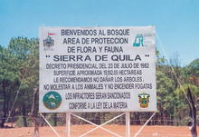
The mountain Sierra de Quila is located in a wooded region of the Mexican state of Jalisco southwest of the city of Guadalajara as from east-northeast to west-southwest and running by the municipalities ( municipios ) Tecolotlán , Tenamaxtlan , Atengo , San Martín Hidalgo and Cocula framed. The entire area of the Sierra de Quila covers 32,000 hectares, the part of the nature reserve (ANP; área natural protegida ) Sierra de Quila approx. 15,500 hectares.
topography
The state of Jalisco is embedded in the contact zone between the Sierra Madre Occidental and the Eje Neovolcánico Transversal (or Transmexican Volcanic Mountains) within the Sierra Madre Occidental and the Sierra Madre del Sur . The Sierras in Mexico are continuations of the North American Cordilleras . Strong endogenous and exogenous processes are the cause of the highly differentiated landscape. With a mountainous relief and valleys of small extent, the Sierra de Quila is part of the Central Mexican Volcanic Mountains ( Eje Volcánico Transversal , sub-province of Sierras de Jalisco), to which, for example, the well-known Volcán de Colima belongs. Gradients of 15–60% emphasize the strong relief energy of the Sierra de Quila, where an increase of up to 1500 m can be recorded over a distance of a few kilometers. The heights of the area range from 1300 m to 2560 m on the Cerro El Huehuentón mountain . Other mountains over 2000 m high are u. a. Cerro El Campanario ( 2250 m ), Cerro Los Lobos (2200 m), Cerro El Picacho Aspero (2300 m) and Cerro La Cruz (2050 m). The border of the nature reserve runs along an isohypse of 2000 m in the north and 1600 m in the south. The largest plateau ( meseta ) is located in the northeast of the Sierra de Quila at 1950 m, on it lies the name of the Sierra, the village of Quila El Grande . Due to the morphological structure of the area, there are pronounced differences in precipitation due to windward-leeward effects.
geology
A defining event for the landscape of the Sierra was strong volcanic activity in the Tertiary . Only small areas are of older date and of Cretan origin. Numerous geological breaks, faults , volcanic formations, tectonic trenches and valleys form geomorphological regional structures. The area consists mainly of extrusive rock , especially feldspar basalt. This effluent rock is found on 80% of the territory. In the north-east of the Sierra one can find a greater spread of tuff . A small area to the southwest is penetrated by 65 million year old granites , while ultimately south of Quila El Grande, alluvial soils of Quaternary origin can be found with a small extent . The mountains of the Sierra de Quila are surrounded by tertiary sediments , primarily limestone and sand-lime stones , which are industrially mined.
Floors
The dominant soil types (according to the World Reference Base ) are the haplic Phaeozems , which are rich in organic material and nutrients and, on the other hand, the poor, moderately fertile eutric regosols . The former is distributed northwest at Quila El Grande and in the surrounding area, at Cerro El Huehuentón and point by point in smaller areas of the Sierra. The Regosols are mainly found in the center of the area. Due to their unfavorable hydraulic conditions, they are disadvantaged, especially in the dry season , so that dead fuel can quickly accumulate here and offer favorable conditions for forest fires. Other soils found are: humic cambisols , eutric cambisols, luvic phaeozem , litosols , vertisols (associated with river courses) and luvisols . They behave largely differently and are distributed over smaller areas, so that one cannot specifically deduce the forest fire behavior. A problem that occurs frequently in the Sierra de Quila is that of soil degradation or soil erosion as a result of uncontrolled deforestation through illegal logging, forest fires and insect pests.
Hydrological conditions
One of the outstanding protection grounds for the Sierra de Quila is its importance as a water reservoir with considerable importance for the drinking and industrial water supply for around 80,000 people in the surrounding area. The mountains form part of the watershed that separates the catchment area of the Río Ameca in the north and that of the Río Armería in the south. Many streams running northwards form the Río Grande, which in turn feeds the San Joaquín y Pedro Virgen reservoir and flows into the main river Ameca. Originally, Lake Chapala was drained by the Río Ameca, but its outflow is blocked by young volcanic deposits. Now the drainage runs over the Río Grande de Santiago , which cuts through the Sierra Madre Occidental in a breakthrough valley. In the south, the rivers of the Río Tecolotlán and the Río Atengo unite to form the Río Ayuquila , which is used for irrigation in agriculture. Especially in the rainy period from July to September, the running waters are water-bearing. The Sierra de Quila, together with the Sierra de la Primavera , Sierra de Ahuisculco , the Volcán de Tequila and the Sierra de Ameca, delimit a hydrological catchment area, Cuenca Tala-Ameca , with a size of approx. 13.4 km².
Climatic conditions
The northern tropic runs north of the Sierra de Quila, which can therefore be assigned to the tropics in terms of radiation . Due to the mountainous topography of the Sierra de Quila, the altitude gradient corresponds to the climatic gradient, that is, between the valleys and the higher altitudes there are different climates with occasional frost. Because of the marginal tropical and subtropical location, the tropical trade fair circulation and the extra- tropical westerly wind circulation determine the climate and weather . By shifting the intra- tropical convergence zone up to the southwest coast of Mexico, tropical Mexico comes under the influence of tropical- convective precipitation at the seasonal peak of the sun . In winter, on the other hand, the marginal tropical-subtropical high pressure belt influences the land with descending air movements and cloudless and very dry weather occurs . As a consequence of the northeast trade winds, there is also the drier climate of the western (Pacific) slope of Mexico and the leeward side of the mountains in the trade shade. The number of humid and arid months forms an essential basis for classifying the climate and vegetation . The Sierra de Quila is located in a semi-arid climate zone with 4–6 humid months, a dry climate with a short rainy season. A climate classification can be made according to W. Koeppen , which was modified by García. Two subclimate types dominate. The first of the two is an (A) C (W1) (W) climate: warm and temperate climate, the temperature of the coldest month is between 18 and -3 ° C and is characterized by predominant summer rain. This applies above all to the central part and the east-west direction. The other type is a C (W2) (W) climate and is found mainly towards the center-north of the Sierra. It is described as moderately dry in winter with mean annual temperatures of 12 to 18 ° C, temperatures of the coldest month between 18 and –3 ° C. Precipitation in the Sierra de Quila varies between 700 and 1000 mm annually, but can be 40 mm in the dry season between October and June. The importance of this climate distribution and the strong relief becomes clear when examining the forms of vegetation. As the Río Grande de Santiago breaks through the Sierra Madre Occidental, pacific northwest winds can bring heavy rainfall to Jalisco. Overall, the Eje Neovolcánico Transversal stands out from the relatively dry highlands with rainfall of or more than 1000 mm.
vegetation
Due to the topographical, climatological, geological and edafological characteristics of the mountains, special types of vegetation are presented. According to Rzedowski, the Sierra de Quila is located in a flora region of the Serranías Meridionales ( Meridional Mountains ), in which oak , pine and oak-pine or pine-oak forests predominate. These areas are those with the highest altitudes in Mexico and, due to their partially isolated location, favor the development of numerous endemic species . Many Holarctic species (oak, pine) probably immigrated to Mexico during the Pleistocene glaciers along the North American Cordilleras . The researchers from the University of Guadalajara ( Universidad de Guadalajara ) Guerrero and Lopéz carried out vegetation studies for the first time in 1997 for the Sierra de Quila, which showed the importance of the species existing here overall for the genetic resources of Mexico.
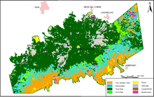
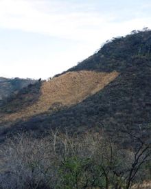
The six main vegetation types listed reflect the different environmental conditions that have an influence on the vegetation in the Sierra de Quila. On the one hand, there are the soil types that are encountered depending on the altitude gradient (1600 to 2560 m), but also the conditions that result from the varying topographical, geological and climatic conditions. Currently, the vegetation of the Sierra de Quila is exposed to various disorders, under which forest fires, illegal exploitation and colonization, overgrazing, shifting cultivation and diseases (mistletoe species and insects) the most important. In the areas of the Sierra that are less affected by soil erosion, there is no intensive ground vegetation to be found, even in the rainy season, there is only a significant layer of grass and herbs in isolated cases. The situation is different with the shrub vegetation, which is important for the transition between the soil and crown layers. Depending on the location, the terrain and geoecofactors , there is a distribution of dense Maturral xerófilo or Pastizal , which consist of deciduous shrubs such as Heliocarpus terebinthaceus ( Majagua ) u. a. consist. At other locations, the shrub growth is completely absent or is only inconspicuously pronounced.
Road and path network
In terms of traffic, the mountains are sufficiently well developed, even if parts of the Sierra are only accessible on foot. The main roads are paved or only unpaved inside the protected area. The total network of roads including all passable breaches , paths or paths is around 180 km. The importance of this distribution of the routes becomes clear when one takes into account the anthropogenic origin of most forest fires. Since the paths are mainly used by day trippers, campers and, above all, transport traffic, there is an even penetration of the area. So not only places of major tourist importance (base station La Ciénega , Salto Seco ) are heavily frequented, but also connecting roads for the removal of wood or transit roads . There are several other indirect connections or normal access routes for wood removal, as access to La Ciénega or to the crossing. The named localities are also the main access to the Sierra, in their vicinity agricultural cooperatives ( ejidos ) cultivate the soil, which are nevertheless part of the protected area. At present, on a fortified, u. U. paved connection built between Quila El Grande and Tecolotlán. The management of the protected areas ( Comité pro Conservación de los Bosques y Manantiales de la Sierra de Quila ) is now expressing the fear that easier access to the reservation will result in more tourists contributing to the disruption and that the new road will facilitate the removal of illegally felled timber.
Web links
- Website of the nature reserve (Spanish)
literature
- BM Cházaro and N. Guerrero, JJ (1995): Datos generales sobre la Sierra de Quila, Jalisco , in: BM Cházaro [u. a.] (1995): Antología del estado Jalisco , Méx. Depto. de Geografía y Ordenación territorial, UdeG, Guadalajara
- D. Davis and P. Holmgren (2000): Fra 2000 - Bibliografía Comentada Cambios En La Cobertura Forestal México. FAO, Rome
- E. García (1981): Modificaciones al sistema de clasificación climática de Koeppen . 3rd ed., Inst. De Geografía de UNAM, México DF
- M. Graudßus, R. Villavicencio García and A. Rodríguez Gallegos (2004): Riesgo de incendios forestales y manejo del fuego para el Área de Protección de Flora y Fauna Sierra de Quila, usando Sistemas de Información Geográfica (GIS). in: Avances en la investigación cientifica en el Centro Universitario de Ciencias Biológicas y agropecuarias . XV Semana de la Investigación Cientifica 11/2004
- N. Guerrero, JJ and C. López, GA (1997): La vegetación y la flora de la Sierra de Quila. FOMES Universidad de Guadalajara
- J. Rzedowski (1978): La vegetación de México . LIMUSA, México DF
- SEMARNAP (ed.) Comisión nacional de ecología (CNE) (undated): Áreas naturales protegidas. CNE, México DF
- G. Sommerhoff and C. Weber (1999): Mexico . Darmstadt, Wiss. Book company
Coordinates: 20 ° 20 ′ N , 104 ° 0 ′ W


