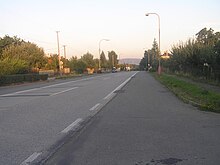
Skoky (Dolní Újezd)
| Skoky | ||||
|---|---|---|---|---|
|
||||
| Basic data | ||||
| State : |
|
|||
| Region : | Olomoucký kraj | |||
| District : | Přerov | |||
| Municipality : | Dolní Újezd | |||
| Area : | 188 ha | |||
| Geographic location : | 49 ° 33 ' N , 17 ° 31' E | |||
| Height: | 352 m nm | |||
| Residents : | 343 (March 1, 2001) | |||
| Postal code : | 751 25 | |||
| License plate : | M. | |||
| traffic | ||||
| Street: | Velký Újezd - Lipník nad Bečvou | |||
Skoky (German Skok ) is a district of the municipality of Dolní Újezd in the Czech Republic . It is located five kilometers northwest of Lipník nad Bečvou and belongs to the Okres Přerov .
geography
Skoky is located on the right side above the valley of the Lubeň brook in the southern foothills of the Oder Mountains . The Libavá military training area extends to the north . To the north rises the Lomec (583 m), in the northeast the U Boudy (523 m) and the Slavkovský vrch (636 m). The R 35 / E 462 / E 442 expressway runs on the northern edge of the village .
Neighboring towns are Kyjanice and Ranošov in the north, Slavkov in the northeast, Bohuslávky in the east, Dolní Újezd in the southeast, Tupec in the south, Veselíčko , Lukavec and Stání in the southwest, Svrčov, Pančava and Výkleky in the west and Staměřice , Zavadilka and Mokřice in the north-west.
history
In 1806, the innkeeper Josef Beck received the concession to build an inn above Dolní Újezd on the Kaiserstraße from Olomouc to Leipnik . Ten years later Beck handed the Gasthaus zum Grünen Baum over to his son of the same name. During this time, the Újezd colony was built along the road, which consisted of 16 houses in 1820 and was expanded until 1822. The colony did not initially have a special name and was also integrated into the house numbering after Dolní Újezd. Until the middle of the 19th century, the settlement, which was popularly named after the dance events in the Green Tree Skoke , as part of Dolní Újezd, was always subject to Leipnik and Prince Dietrichstein .
After the abolition of patrimonial formed Skoky / Skok - Kokaun 1850 a settlement of Dolní Újezd in the district administration Moravian Weisskirchen . In 1855 the community was assigned to the Leipnik district, from 1868 it belonged again to the Mährisch Weißkirchen district. Since 1880 the place was called Skoky / Skok . In 1924 Skoky broke away from Dolní Újezd and formed its own community. In the course of the territorial reform of 1960 and the dissolution of the Okres Hranice, Skoky was incorporated into Staměřice on January 1, 1961 and at the same time assigned to the Okres Přerov . In 1976 the municipality of Staměřice with the district Skoky and the settlement Zavadilka was attached to the Local National Committee Dolní Újezd and in 1983 it was completely incorporated. In 1991 there were 285 people in Skoky. At the end of the 1990s, the R 35 expressway was built north of the village ; Since it cut through a bio-corridor on the slope of the Oder Mountains, the Dolní Újezd tunnel was built east of Skoky between 1997 and 1998. The 2001 census counted 120 houses and 343 residents.
Attractions
- Chapel of St. John of Nepomuk, on the village square, built around 1824
- Stone cross on the village square, erected in 1881 instead of a wooden cross from 1824
- R 35 tunnel, built 1997–1998 for 80 million crowns
Web links
Individual evidence
- ↑ Místopisný rejstřík obcí českého Slezska a severní Moravy (p. 558-559) ( Memento of the original from March 4, 2016 in the Internet Archive ) Info: The archive link was inserted automatically and has not yet been checked. Please check the original and archive link according to the instructions and then remove this notice. (PDF; 2.2 MB)


