South Bay (Boston)

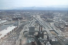
South Bay is a 10 acres (about 40,500 sqm ) area encompassing the city of Boston in the state of Massachusetts of the United States . The area is located between the Chinatown and Leather District districts and is roughly bounded by Kneeland and Hudson Streets as well as the Massachusetts Turnpike and I-93 .
The area was owned by the Massachusetts Turnpike Authority (MTA) in 2007 and was being prepared for further development to be implemented after the Big Dig was over. Were planned in particular parks , museums and urban spaces as the southern anchor point of the Rose Kennedy Greenway . In terms of area size and scope of construction, this is the largest project in Boston since the Prudential Tower was built in 1964. The course of the surrounding streets should be taken into account.
History of the site
The South Bay district, like the neighboring Chinatown and Leather District, is on land reclaimed land . Originally part of the area was part of Bay Village and was populated in 1833 by the South Cove Corporation , who built an intermodal rail / ship terminal there for the Boston and Worcester Railroad . This also included the development of residential and commercial areas as well as the construction of what was probably the largest hotel in the United States at the time. For most of the 19th and early 20th centuries, South Bay was mainly used for depots for trains coming from the south and west.
The railroad drew companies from the leather and clothing industry to the district, which among other things built the buildings in the neighboring Leather District . At the same time, the railroad served as a travel route for immigrants , which was particularly true for Asians , including many Chinese , until the early 19th century .
In the 1950s, much of the railroad lines were relocated to build the John F. Fitzgerald Expressway . The Big Dig changed the area again and released new building plots.
Coordinates: 42 ° 21 ′ N , 71 ° 4 ′ W