
Velem
| Velem | |||||
|
|||||
| Basic data | |||||
|---|---|---|---|---|---|
| State : | Hungary | ||||
| Region : | Western Transdanubia | ||||
| County : | Vas | ||||
| Small area until December 31, 2012 : | Kőszeg | ||||
| District since 1.1.2013 : | Kőszeg | ||||
| Coordinates : | 47 ° 21 ' N , 16 ° 30' E | ||||
| Area : | 8.61 km² | ||||
| Residents : | 333 (Jan. 1, 2011) | ||||
| Population density : | 39 inhabitants per km² | ||||
| Telephone code : | (+36) 94 | ||||
| Postal code : | 9726 | ||||
| KSH kódja: | 26000 | ||||
| Structure and administration (status: 2014) | |||||
| Community type : | local community | ||||
| Mayoress : | Józsefné Szél (independent) | ||||
| Postal address : | Rákóczi u. 73 9726 Velem |
||||
| Website : | |||||
| (Source: A Magyar Köztársaság helységnévkönyve 2011. január 1st at Központi statisztikai hivatal ) | |||||


Velem (German: St. Veit in Vas County ) is a Hungarian municipality near the Austrian border, 6 km southwest of Kőszeg (Güns), on the slopes of the Güns Mountains . The place is in the area of the Geschrittenstein-Írottkő Nature Park .
history
Archaeologists found 2000 year old Roman water pipes at the Heiligenbrunn spring, which led the water to Savaria , today's Szombathely . The fleeing Szálasi government kept St. Stephen's crown in the Villa Stirling between December 29, 1944 and March 19, 1945.
Attractions
- St. Vitus Church on St. Vitus Hill ( Hungarian Szent Vid-kápolna )
- The still functioning mill, named after the former Schulte milling family, was mentioned in a document as early as 1568. It was dismantled in 1913 and rebuilt the following year. It is now a listed building and is home to a museum.
- Chestnut forest with chestnut trees that are over 200 years old
Others
- Annually on June 15, commemoration of the cholera epidemic in 1849
- Church day of the St. Vitus Church
- "Spring Welcome" festival
- Chestnut Festival
- Grape harvest
- Day of the Birds and Trees
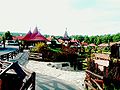
photos

Aerial view of St. Veit


St. Vitus Church on the mountain of the same name


Web links
Commons : Velem - collection of images, videos and audio files