St. Vincent
| St. Vincent | |
|---|---|
| Waters | Caribbean |
| Archipelago | Windward Islands |
| Geographical location | 13 ° 15 ′ N , 61 ° 12 ′ W |
| surface | 346 km² |
| Highest elevation |
Soufrière 1220 m |
| Residents | 124,518 (2005) 360 inhabitants / km² |
| main place | Kingstown |
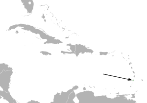
| Map of St. Vincent | |
St. Vincent ( English Saint Vincent ) is an island in the Caribbean . St. Vincent was also the name of the British colony whose main island was the island of St. Vincent and which became independent under the changed name of St. Vincent and the Grenadines .
geography
St. Vincent is one of the Windward Islands , which are part of the Leeward Islands are. The Grenadines stretch south of St. Vincent , the closest is the island of Bequia, 14 km away . North is St. Lucia , south of Grenada and is around 180 km east of Barbados .
The largest city is the capital Kingstown with 16,416 inhabitants (as of 2012). Other places are Adelphi , Georgetown , Byera , Barrouallie and Owia .
St. Vincent has a mountain range covered with primeval forest ( Bonhomme ), an active volcano ( Soufrière 1220 m , last eruption 1979), numerous streams and a pleasant climate.
The island is 346 km² in size, bananas , sugar cane , cotton , coconuts , arrowroot and the like are grown.
License plate is WV. A ferry runs regularly between the capital Kingstown and the neighboring island of Bequia. The island has an airport with the IATA airport code SVD .
history
The first settlement was by the Arawak , followed by the Caribs . The first Africans reached the archipelago in 1635 when two English slave ships were shipwrecked in a storm near St. Vincent. A large number of Africans were able to free themselves from the wrecks and flee, they were taken in by the island caribs (Kalipona) and mixed with them. The result was an ethnic group called the Black Caribs (and later the Garifuna ), who repeatedly managed to remain independent in the tension between England and France.
The island was divided between the great powers England and France before becoming part of the United Kingdom in the Treaty of Versailles in 1783 .
William Bligh , former commander of the Bounty , brought the breadfruit from the Pacific to the island on January 24, 1793 with HMS Assistance . This was needed in the Caribbean because the conflict during the American War of Independence (1775–1783) meant that cheap wheat deliveries from North America did not materialize and plantation operators throughout the region were looking for a new, cheap staple food for their slaves.
With the expansion of the slave economy on the sugar cane plantations, the Garifuna were viewed with suspicion by the colonists, as they represented an example of free blacks. Armed conflicts broke out between the British on the one hand and Garifuna and French on the other (Caribbean War) 1796 ended with the complete defeat of the Garifuna and the French. The defeated Garifuna were first deported to the nearby island of Baliceaux , then relocated to the island of Roatán off the Honduran coast.
In 1871 St. Vincent was incorporated into the Crown Colony of the Windward Islands . From 1958 to 1962, St. Vincent was part of the short-lived West Indian Federation . In 1979 the state of St. Vincent and the Grenadines became independent but remained in the Commonwealth .
St. Vincent as a film set
St. Vincent was one of the filming locations for Pirates of the Caribbean . Additional jetties and buildings were made, which were necessary as scenery for the filming, and several hundred locals were hired for auxiliary work.
Sons and daughters
- Frederick Ballantyne (1936–2020), Governor General of St. Vincent and the Grenadines
- Franklyn Seales (1952–1990), American film and stage actor
- Marlon Roudette (* 1983), singer in the British band Mattafix
- Kevin Lyttle (born 1976), singer
- Lansdown Guilding (1797-1831), naturalist
- John Roche Dakyns (1836-1910), English geologist


