List of municipalities in the Steyr urban region
The urban region of Steyr is an Austrian agglomeration in Upper Austria and Lower Austria . The region consists of the core zone (code: SR131) and the outer zone (code: SR132) .
History of the classification
The delimitation of the urban regions (urban centers) was carried out by Statistics Austria for 1971 to 2001 every 10 years. For the reference date October 31, 2013, delimitation was carried out for the first time according to the urban-rural typology developed by Statistics Austria for statistical purposes , which integrates the delimitation of the city regions.
List of municipalities according to the 2001 delimitation
- The population figures in the lists are from January 1, 2020.
- Regions are small regions in Lower Austria (as of September 2016)
Steyr core zone
| local community | location | Ew | km² | Ew / km² | Judicial district | region | Type
|
photo | Metadata |
|---|---|---|---|---|---|---|---|---|---|
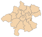
Steyr
|
|
38,056 | 26.54 | 1434 | Steyr | - | Statutory city
|

|
According to code: 40201 |
Dietach
|

|
3,270 | 20.7 | 158 | Steyr | - | local community
|

|
Acc. To code: 41504 |
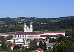
Cooked
|

|
6,640 | 53.29 | 125 | Steyr | - | market community
|
|
Acc. To code: 41506 |
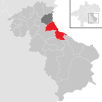
Ortisei near Steyr
|
|
3,043 | 39.1 | 78 | Steyr | - | local community
|

|
Acc. To code: 41514 |
Outside zone Steyr
| local community | location | Ew | km² | Ew / km² | Judicial district | region | Type
|
photo | Metadata |
|---|---|---|---|---|---|---|---|---|---|
Aschach an der Steyr
|

|
2,312 | 21.92 | 105 | Steyr | - | local community
|

|
Acc. To code: 41502 |
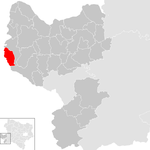
Behamberg
|
|
3,426 | 20.26 | 169 | Amstetten | 53 Mostviertel origin | local community
|

|
According to code: 30506 |
Haidershofen
|

|
3.714 | 31.93 | 116 | Amstetten | 53 Mostviertel origin | local community
|

|
According to code: 30515 |
Laussa
|

|
1,232 | 34.48 | 36 | Steyr | - | local community
|

|
Acc. To code: 41508 |
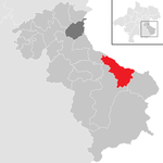
Maria Neustift
|
|
1,614 | 45.87 | 35 | Steyr | - | local community
|

|
According to code: 41510 |
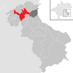
Sierning
|
|
9,375 | 38.28 | 245 | Steyr | - | market community
|

|
According to code: 41516 |
Wolfern
|

|
3,178 | 32.57 | 98 | Steyr | - | market community
|

|
Acc. To code: 41521 |
See also
Web links
Individual evidence
- ↑ Classifications according to urban and rural areas . STATISTICS AUSTRIA. Retrieved July 18, 2019.