State Highway 11 (Wisconsin)

|
|
|---|---|
| map | |

|
|
| Basic data | |
| Overall length: | 157.56 mi (253.57 km) |
| State: |
Wisconsin |
| Starting point: |
|
| End point: |
|
| Counties: |
Grant Lafayette Green Rock Walworth Racine |
| Important cities: |
Monroe Janesville Elkhorn Burlington Racine |
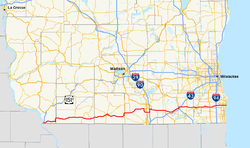
The State Highway 11 (Wisconsin) (also State Trunk Highway 11 , Highway 11 , STH 11 or WIS 11 ) is running from west to east State Road through the south of the US -amerikanischen state of Wisconsin . The western end point is a few kilometers south of the small town of Kieler , across from the city of Dubuque in Iowa . There, Highway 11 begins a few hundred meters east of the Dubuque-Wisconsin Bridge over the Mississippi, together with WIS 35, at the confluence with US Highways 61 and 151, which run on a common stretch of road here . The eastern end point is at the confluence with WIS 32 about 400 m west of Lake Michigan on the eastern edge of the city of Racine, which is part of the Milwaukee metropolitan area .
course
About 500 m after the western end point, the WIS 35 branches off from the common route to the south to the Illinois border about one kilometer away . The WIS 11 initially runs through relatively sparsely populated area in Grant County . Before the border with Lafayette County , the WIS 80 branches off to the north.
After about 20 km the WIS 23 branches off to the north and in the Gratiot a few kilometers further east the WIS 78 branches off to the south.
After the bridge over the Pecatonica River near Browntown in Green County , the road reaches its administrative seat Monroe , where the highway forms the four-lane northern bypass. There the WIS 81 joins from the north and continues with the WIS 11 on the same route. The WIS 69 also crosses here and the WIS 59 reaches its southern end point. After the bridge over the Sugar River , the WIS 81 leaves the joint route. Then the highway reaches the city of Brodhead with the southern end point of WIS 104 , which also forms the border with Rock County .
In Orfordville the WIS 213 crosses and after the bridge over the Rock River reaches the city of Janesville . First, the highway passes the Southern Wisconsin Regional Airport to the south and crosses US Highway 51 before reaching Interstate Highways 39 and 90 , which run together in a north-south direction . Highway 11 now runs northwards together with the interstate and leaves it after around 8 km in an easterly direction. The highway now runs first in a south-easterly and later in an easterly direction together with US Highway 14 .
After 25 km, Highway 11 in Walworth County leaves the joint section and reaches the town of Delavan . From now on, the road runs in a north-easterly direction parallel to Interstate 43, 2 to 3 km away, to Elkhorn . The WIS 67 crosses in the city . After the intersection with the four-lane US Highway 12 , the course turns again in an easterly direction and a little later crosses the I 43. After the intersection with the WIS 120 , the road reaches the Racine County border after the intersection with the WIS 36 .
The WIS 11 now forms the southern bypass of the city of Burlington and crosses the Fox River over a bridge . After the junction with WIS 83 , the highway leaves the Burlington area and continues east. After the intersection with the WIS 75 and later the US Highway 45 in Union Grove, the Interstate 94 crosses shortly before the city of Sturtevant , which runs here on the same route as the US Highway 41 . After the intersection with the WIS 31 , the WIS 11 enters the urban area of Racine. Here the street now leads through the entire southern urban area. At the south-eastern city limits, the highway reaches its eastern end point at the confluence with WIS 32.
See also
- List of state, US, and interstate highways in Wisconsin
- List of United States highways
- List of American interstate highways