
Steigerthal (Nordhausen)
|
Steigerthal
City of Nordhausen
|
|
|---|---|
 |
|
| Height : | 232 m above sea level NN |
| Incorporation : | April 1, 1999 |
| Postal code : | 99734 |
| Area code : | 03631 |
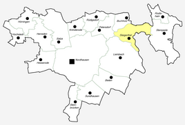  Location of Steigerthal in Nordhausen
|
|
 Steigerthal in a snow coat
|
|

Steigerthal is a rural district of the city of Nordhausen in Thuringia .
location
Steigerthal is located northeast of the city of Nordhausen on Landesstraße 2076 in the hilly terrain of its district in the southern foothills of the Harz Mountains . The area monument Pfaffenköpfe is in the hallway .
history
The first documentary mention of Steigerthal took place on June 11, 1288.
A fortified church stood between Steigerthal and Buchholz. From this church, which belongs to the desert of Hunsdorf , there are ruins, wall and moat.
On April 1, 1999, Steigerthal was incorporated into Nordhausen.
church
Personalities
- Georg Gotthilf Evers (1837–1916), Lutheran theologian, convert to Catholicism, book author and botanist, officiated here from 1868 to 1873 as Lutheran pastor
Web links
- Steigerthal at: www.nordhausen.de
Individual evidence
- ↑ Official topographic maps of Thuringia 1: 10,000. Eichsfeldkreis, LK Nordhausen, Kyffhäuserkreis, Unstrut-Hainich-Kreis . In: Thuringian Land Survey Office (Hrsg.): CD-ROM series Top10 . CD 1. Erfurt 1999.
- ^ Wolfgang Kahl : First mention of Thuringian towns and villages. Verlag Rockstuhl, Bad-Langensalza, 2010, ISBN 978-3-86777-202-0 , p. 272.
- ↑ Michael Köhler: Thuringian castles and fortified prehistoric and early historical living spaces. Jenzig-Verlag, 2001, ISBN 3-910141-43-9 , p. 145.
- ↑ StBA: Changes in the municipalities in Germany, see 1999

Districts:
Bielen |
Buchholz |
Talk |
Hesserode |
Hochstedt |
Hörningen |
Leimbach |
Petersdorf |
Rodishain |
Steigerthal |
Stone bridges |
Stempeda |
Sundhausen
districts:
Krimderode |
Nordhausen |
Rüdigsdorf |
Salza