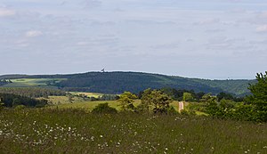
Stockert (mountain)
| Stagnates | ||
|---|---|---|
| height | 433.9 m above sea level NHN | |
| location | between Eschweiler and Holzheim ; Münstereifeler Wald , North Rhine-Westphalia ( Germany ) | |
| Mountains | Eifel | |
| Coordinates | 50 ° 34 '10 " N , 6 ° 43' 18" E | |
|
|
||
| particularities | Radio telescope Astropeiler Stockert | |
The Stockert between Eschweiler and Holzheim in the North Rhine-Westphalian district of Euskirchen is 433.9 m above sea level. NHN high mountain of the Münstereifel forest in the Eifel . The Astropeiler Stockert radio telescope stands on top of it .
geography
location
The Stockert rises in the west of the Münstereifel forest . Its summit is 1.4 km west-southwest of Eschweiler , a district of Bad Münstereifel , 1.8 km east of Holzheim and 1.8 km (as the crow flies ) south-east of Weiler am Berge , both of which belong to the city of Mechernich ; the border between the two cities runs over the summit. A section of the Eschweiler Bach runs south-east past the mountain and flows into the Erft around 3 brook kilometers further east in Bad Münstereifel . The mountain is partially forested, but in the summit region of the Astropeiler Stockert there is no forest, and its high elevations in the north and west are used for agriculture.
Natural allocation
The Stockert belongs in the natural spatial main unit group Eastern Eifel (No. 27) and in the main unit Münstereifeler Wald and Northeastern Eifelfuß (274) to the subunit Münstereifeler Tal (274.0), with its landscape facing north in the main unit Mechernicher Voreifel (275) in the subunit Antweiler depression (275.3) and southwest in the main unit Kalkeifel in the sub-unit (276) Sötenicher Kalkmulde drops (276.0).
Protected areas
Parts of the nature reserve (NSG) Kalkkuppenlandschaft between Wachendorf and Pesch ( CDDA -Nr. 329476; 2000; 90 ha ) lie on the northwest flank of the Stockert and on its southern flank those of the NSG Eschweiler Tal and Kalkkuppen (CDDA-Nr. 329470; 1969; 6.36 km² ) and parts of the fauna-flora-habitat area Eschweiler Tal and Kalkkuppen (FFH no. 5406-301; 3.85 km²). Parts of the Euskirchen district landscape protection area (sub-area 1) (CDDA no. 322308; 1981; 795.04 km²) are located to the southwest via northwest to northeast of its summit .
Transport, hiking, leisure
Slightly southwest and west past Mount the lead state roads 165 ( Nöthen - Holzheim ) and 499 (Holzheim- hamlet on mountainside ). From the latter, the district road 45 branches off in Weiler am Berge , which leads east-south-east to Eschweiler . A road leading to the summit region branches off from the K 45 west of Eschweiler . For example, starting at these roads, the mountain can be hiked on forest paths and paths. The golf course of the Bad Münstereifel-Stockert Golf Club is located on the north and east flanks of the Stockert .

