Stockholm archipelago
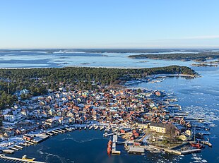
The Stockholm Archipelago ( Swedish Stockholms skärgård ) is an archipelago in the Baltic Sea, east of Stockholm . It is the largest archipelago in Sweden and the second largest archipelago in the Baltic Sea after the Archipelago , which is part of Finland.
geography

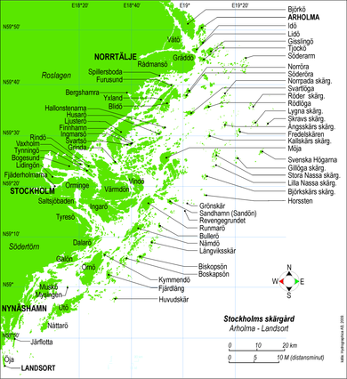
The Stockholm archipelago stretches from Stockholm approx. 60 km to the east, and from the island of Öja in the south to the island of Väddö in the north. It consists of around 24,000 islands. The better-known islands include Dalarö , Grinda , Husarö , Ljusterö , Möja , Rödlöga , Runmarö , Utö , Ornö , Svanholmen and Svartsö .
Trivia
The Ytterby mine , which is located on the island of Resarö in the archipelago, was the inspiration for the naming of the four chemical elements erbium , terbium , ytterbium and yttrium . The element lithium was first discovered in a rock sample from Utö .
Web links
Individual evidence
- ^ Swedish islands . SCB, The Swedish Statistics Agency . Retrieved March 18, 2011.
Coordinates: 59 ° 21 ' N , 18 ° 48' E
