Strada delle 52 gallery
| Strada delle 52 gallery | |
|---|---|
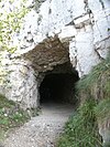
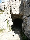
 Entrance tunnel to Strada della 1. Armata |
|
| Data | |
| length | 6.5 km |
| location | Vicenza Province , Italy |
| Starting point | Bocchetta Campiglia 45 ° 46 ′ 44 " N , 11 ° 13 ′ 41" E |
| Target point | Porte del Pasubio 45 ° 47 ′ 3 " N , 11 ° 11 ′ 11" E |
| Type | trail |
| The highest point | 2000 m |
| Lowest point | 1216 m |
The Strada delle 52 Gallerie , also Strada della 1ª Armata or Strada della Prima Armata , is one of the most famous and nowadays most visited Italian military roads of the First World War . It was built to supply the Italian positions on the Pasubio .
Location and construction
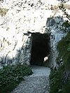
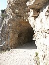
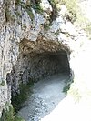
The Strada delle 52 Gallerie is located around 30 kilometers east of Lake Garda on the border of the provinces of Vicenza and Trento . It begins at the Bocchetta di Campiglia ⊙ at an altitude of 1216 meters and leads to the Porte del Pasubio ⊙ at 1928 m. The "road" has a total length of 6300 m, of which around 2300 m run in the 52 tunnels that give it its name (ital. Galleria ). The gradient of the road is up to 22 percent, with an average gradient of twelve percent being mastered. Due to the use of pack animals to supply the positions and the transport of heavy equipment (e.g. parts of artillery pieces), the path was laid out with a minimum width of 2.2 m. A minimum of 3 m was required in curves. It takes a good two and a half hours to climb the plateau.
The construction of the road on the limestone massif began in February 1917 on the south side of the Monte Forni Alti mountain range in order to be protected from the artillery of the Austrian Kaiserjäger in the north. Other supply routes such as the Strada degli Scarubbi were largely unusable due to the constant bombardment.
The planning was carried out by Lieutenant Giuseppe Zappa . The execution was entrusted to the 33rd mining company of the 5th Genieregiment, which belonged to the 1st Army . The actual work was carried out with the support of up to six militarized workers' centuria (Centuries 349, 523, 621, 630, 765 and 776). For example, up to 600 men were working on the construction of the road, which began with 20 men in winter. The road was completed in December 1917.
The construction of the tunnels and the road was primarily carried out with pneumatic drilling machines and blasting. Kilometers of pipes were laid for the compressed air drills, which were supplied with air by two 100 and 60 hp compressors.
particularities
The longest tunnel, the 19th tunnel, is 318 m long. The most impressive tunnel, however, is the 20th tunnel, which leads into the massif, winds upwards through the rock like a corkscrew and only four turns later leads outside again in a rock needle.
During construction, a niche was built into numerous tunnels to accommodate two boxes of explosive gelatine . With this explosive gelatine the tunnels were to be blown up in the event of a retreat and thus made unusable for the advancing enemy.
On the tunnel ceiling of the 12th tunnel, near a tunnel window, there are eleven fossil footprints of various dinosaurs from the Norium in the Upper Triassic . The prints, some of which can only be seen by trained eyes, come from sauropodomorphs and theropods of different sizes. Further dinosaur traces were found on Pasubio west of the Cima Palon and in an Austro-Hungarian war tunnel on Monte Buso .
Trivia
- The Strada delle 52 Gallerie ends at the Rifugio Generale Achille Papa , a mountain hut of the Club Alpino Italiano (CAI) that is only managed in summer. It is named after an Italian general.
- The Gaetano Falcipieri via ferrata runs parallel above the Strada . The Rifugio Generale A. Papa can also be reached on it in around five hours.
- The European long-distance hiking trail E5 also leads over the Strada della Prima Armata and coincides in this section with the peace trail ( sentiero della pace ), which is intended to commemorate the trench warfare in the Alps between Austria and Italy.
- The street and the Pasubio are popular excursion destinations due to their proximity to Lake Garda, the cities of Vicenza and Venice , and are therefore particularly popular on the summer weekends.
- The Strada was a very popular descent with mountain bikers . After several serious accidents and a fatal crash, the road was closed to cyclists and driving on it was subject to a heavy fine.
- Due to the length of the tunnels, the corresponding moisture from frequent fog and the fact that the rock at the bottom of the tunnel is correspondingly smooth due to frequent use, the use of sturdy shoes and a flashlight or headlamp is necessary.
tunnel
|
|
Picture gallery
Web links
- Report on the Strada delle 52 gallery in the explorer magazine (accessed on October 17, 2009)
- Detailed report on the Strada (Italian, accessed on July 14, 2009)


