Takoma Park
| Takoma Park | ||
|---|---|---|
 |
||
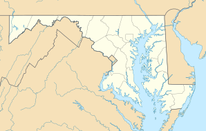
| Location in Maryland | ||
|
|
||
| Basic data | ||
| Foundation : | 1890 | |
| State : | United States | |
| State : | Maryland | |
| County : | Montgomery County | |
| Coordinates : | 38 ° 59 ′ N , 77 ° 0 ′ W | |
| Time zone : | Eastern ( UTC − 5 / −4 ) | |
| Residents : | 16,715 (as of 2010) | |
| Population density : | 7,959.5 inhabitants per km 2 | |
| Area : | 2.1 km 2 (approx. 1 mi 2 ) of which 2.1 km 2 (approx. 1 mi 2 ) are land |
|
| Height : | 121 m | |
| Postcodes : | 20901, 20903, 20912 | |
| Area code : | +1 301 | |
| FIPS : | 24-76650 | |
| GNIS ID : | 0598146 | |
| Website : | www.takomaparkmd.gov | |
 |
||
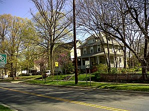
Takoma Park is a city in Montgomery County in the US state of Maryland , United States .
It is located on the northern edge of Washington, DC only about 10 kilometers from the White House .
Here is the Columbia Union College of Seventh-day Adventist Church .
Personalities
sons and daughters of the town
- Jerry M. Woodall (* around 1938), physicist
- John Fahey (1939-2001), guitarist
- Mark S. Sisk (born 1942), Anglican Bishop of the Episcopal Church
- Henry Vestine (1944-1997), guitarist
- Terry Winograd (* 1946), computer scientist
- Bill Reichenbach (* 1949), jazz musician
- Fred Funk (* 1956), golfer
- Helen DeWitt (born 1957), author
- Wayne DeAtley (* 1958), bobsledder
- Sharmba Mitchell (* 1970), world boxing champion
- Danielle Allen (* 1971), political scientist
Personalities related to the city
- John J. Kleiner (1845–1911), politician
- Marion Butler (1863–1938), politician
- B. Frank Murphy (1867-1938), politician
- James J. Davis (1873-1947), politician
- Roscoe Bartlett (born 1926), politician
- Steffen Ufer (* 1940), German defense attorney
- Margit L. McCorkle (* 1942), pianist
Web links
Commons : Takoma Park - collection of pictures, videos and audio files
