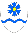
Tartu (rural community)
| Tartu | |||
|
|||
| State : |
|
||
| Circle : |
|
||
| Coordinates : | 58 ° 25 ' N , 26 ° 47' E | ||
| Area : | 298.7 km² | ||
| Residents : | 6,041 (2010) | ||
| Population density : | 20 inhabitants per km² | ||
| Time zone : | EET (UTC + 2) | ||
| Website : | |||

|
|||
Tartu is a rural municipality in the Estonian county of Tartu with an area of 298.69 km². It has 6041 inhabitants (as of December 31, 2010).
geography
Tartu is located north of the city of the same name, Tartu . In the north of the municipality are some lakes, including the Saadjärv and the Soitsjärv . The Estonian National Road 3 runs through the municipality .
structure
In addition to the main town of Kõrveküla , the rural municipality includes the villages of Aovere , Äksi , Arupää, Erala, Haava, Igavere, Jõusa, Kastli, Kikivere, Kobratu, Kukulinna, Kärkna , Kükitaja, Lammiku, Lombi, Länke, Maramaa, Metsanuka, and Metsanuka , Õvi, Puhtaleiva, Pupastvere, Saadjärve, Salu, Soeküla, Soitsjärve, Sojamaa, Sootaga, Taabri, Tammistu, Tila, Toolamaa, Vahi, Vasula, Vedu , Vesneri, Viidike, Vilussaare, Võibla and Väägvere.
Culture and sights
In the village of Äksi, where the Äksi-Kukulinna road joins the Tartu-Jogeva-Aravete road, a memorial commemorates the Estonian War of Liberation (Estonian Vabadussõda ) against Soviet Russia from 1918 to 1920 .
Town twinning
Since 1996 there has been a partnership with the German community association Amt Gelting (since 2008 Amt Geltinger Bucht ) in Schleswig-Holstein and since 2009 with the Finnish city of Jyväskylä .
Born in the church
- Miina Härma (1864–1941), Estonian composer, choir director and organist
- Mait Metsanurk (1879–1957), Estonian writer
- Adalbert Wirkhaus (1880–1961), Estonian composer and conductor
Web links
- Tartu Municipality website (Estonian)
proof
- ^ Tartu vald website , accessed May 31, 2018


